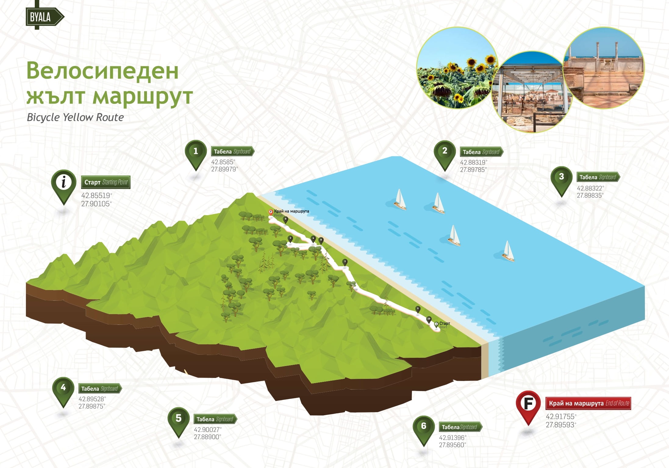
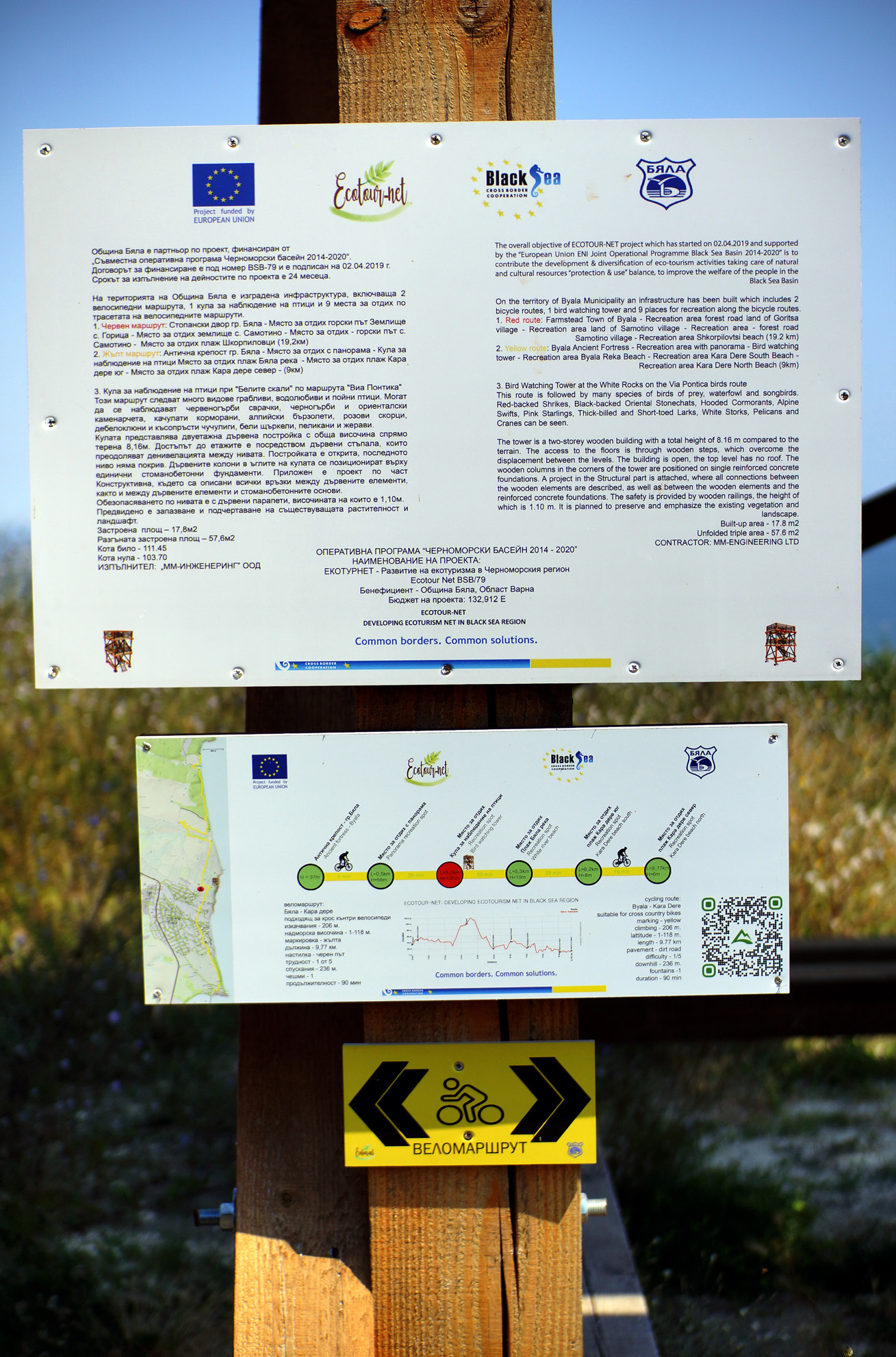
Bicycle Yellow Route
Posted by : BGadmin@ecotournet.net on 20.Sep.21
Last update by : BGadmin@ecotournet.net on 30.Oct.21
Information on Route
Total distance 9.77 km
Elevation gain 206 m
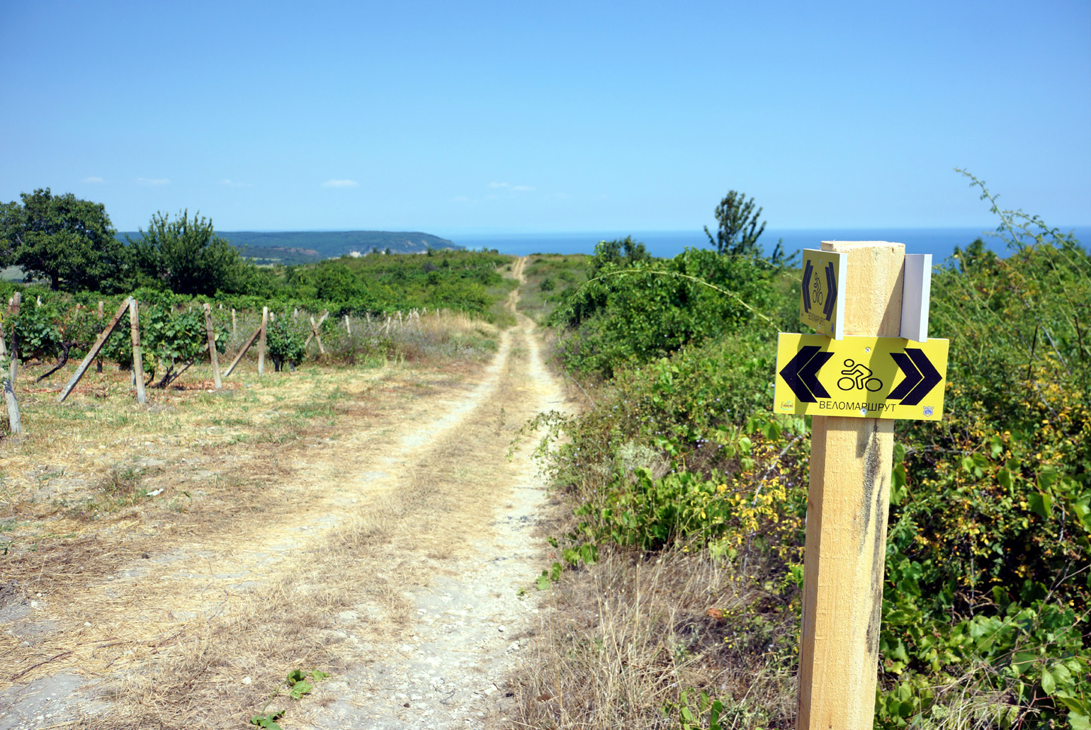
Marking Yellow
Surface Dirt road, Asphalt
Level of Difficulty from 1 to 5
Technical Difficulty from 2 to 5
Points of interest Ancient complex Byala > Place for rest at villa zone > Byala Birdwatching tower > Place for rest at the birdwatching tower > Place for rest at Byala reka beach Aleksa Fountain > Place for rest at Karadere south beach > Place for rest at Karadere north beach
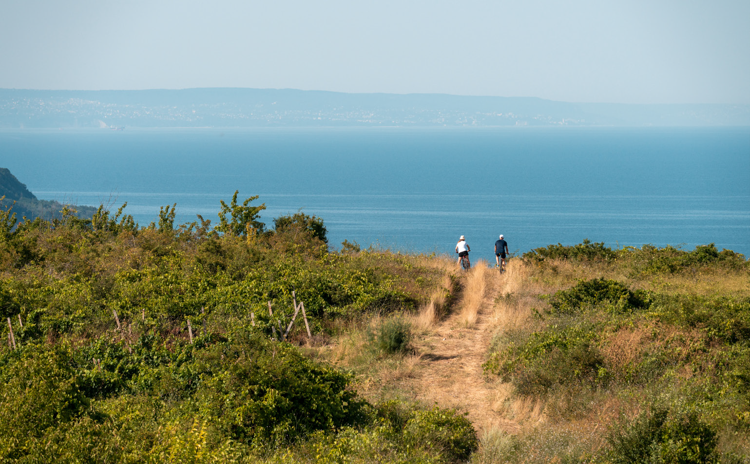
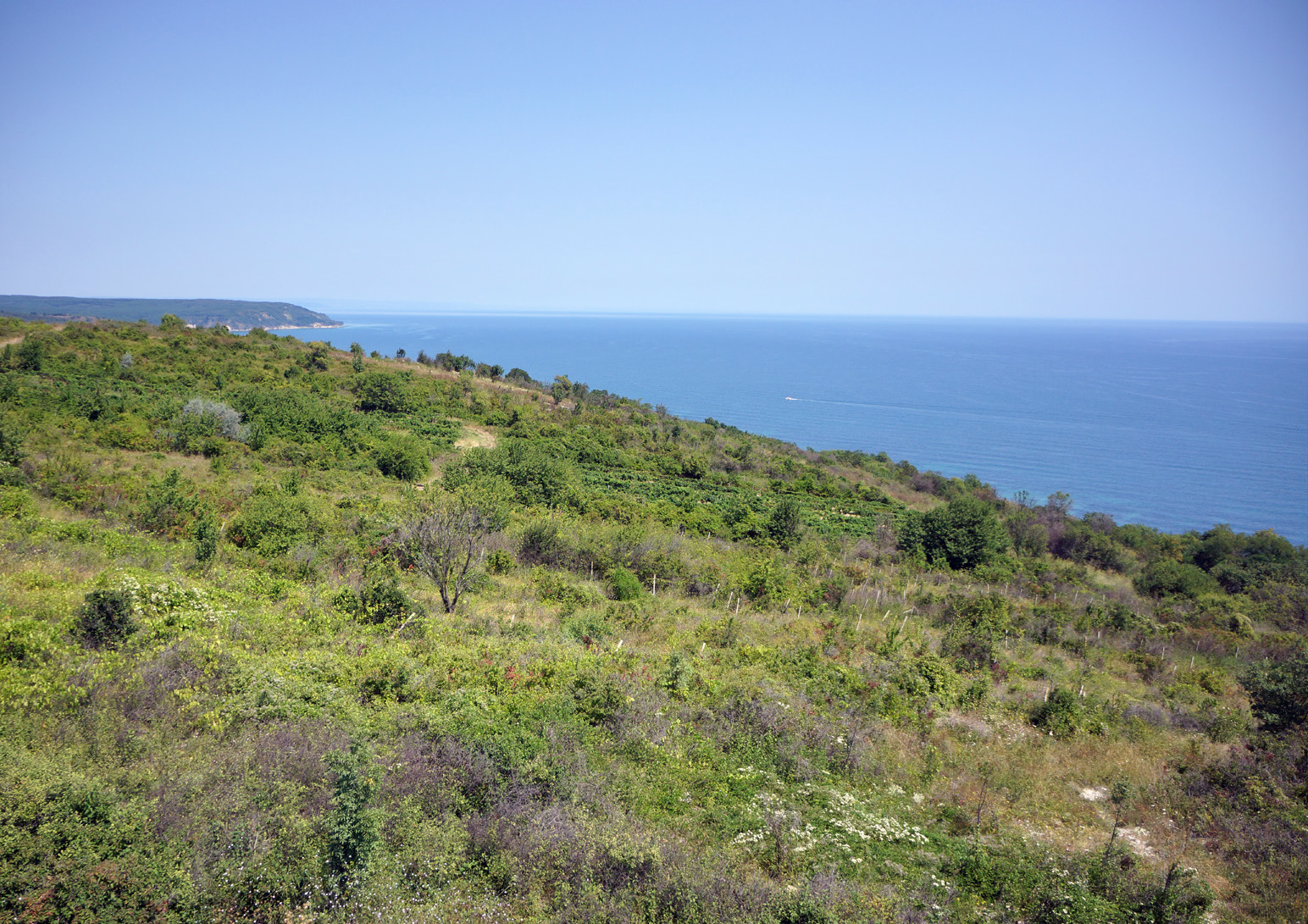
The Byala - Karadere route is a charging adventure, full of sea views from different heights and places. The panoramas along the route, the several viewpoints and especially the birdwatching tower will leave you breathless until you reach the iconic wild beach of Karadere. Due to the short length and relatively small elevation, this ride is suitable for beginners.
However, several short but steep sections can be a challenge, but also a chance to practice the cycling technique. If the tourists decide that they want to add more kilometres to their ride, they can take the additional (connecting) section to the beach of Shkorpilovtsi. It will add another 6 kilometres, and from there they can return by the other route: Byala - Goritsa - Samotino - Shkorpilovtsi. Thus, the kilometres will be a total of 35 and the enjoyment of views of forests and fields will be complete.
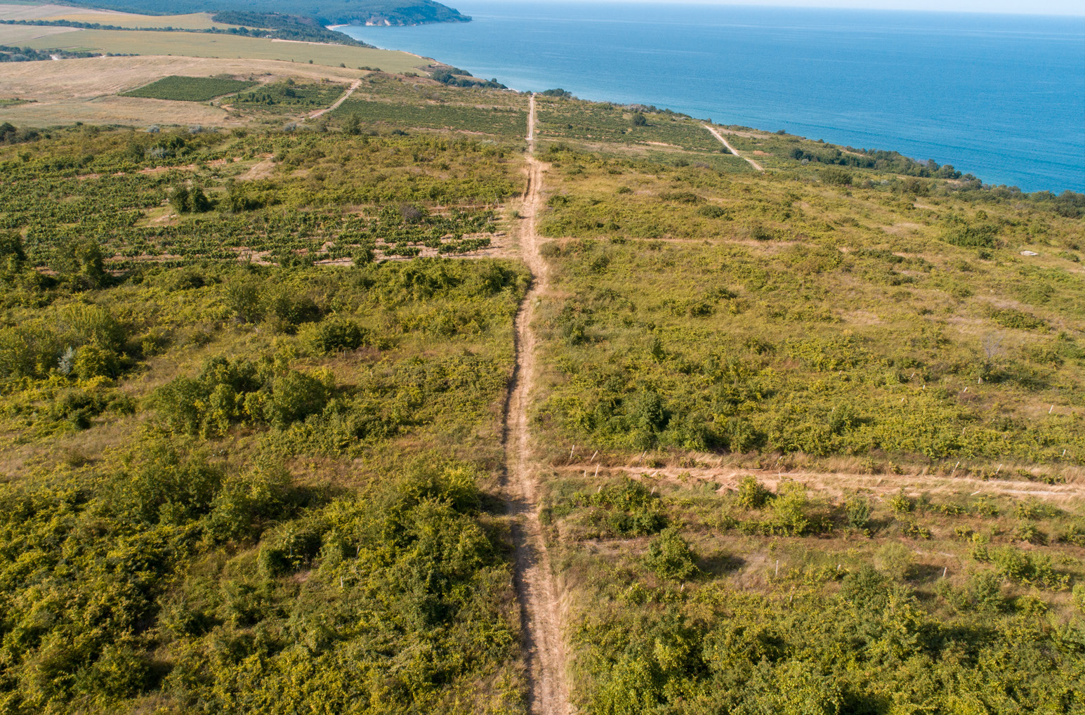
The yellow route for cycling and hiking starts from the ancient fortress on Cape St. Atanas in the town of Byala, passes through the natural landmark White Rocks and the Byala Reka locality, and ends in the beautiful Karadere area. The route is characterized by favourable conditions of the cycling trail, the incredible combination of vast fields, vineyards and wooded areas with beautiful, rocky sea coast and views of the vast expanse of the sea. The historical, archaeological, cultural and ethnographic riches of the territory give unforgettable experiences with a high cognitive effect.
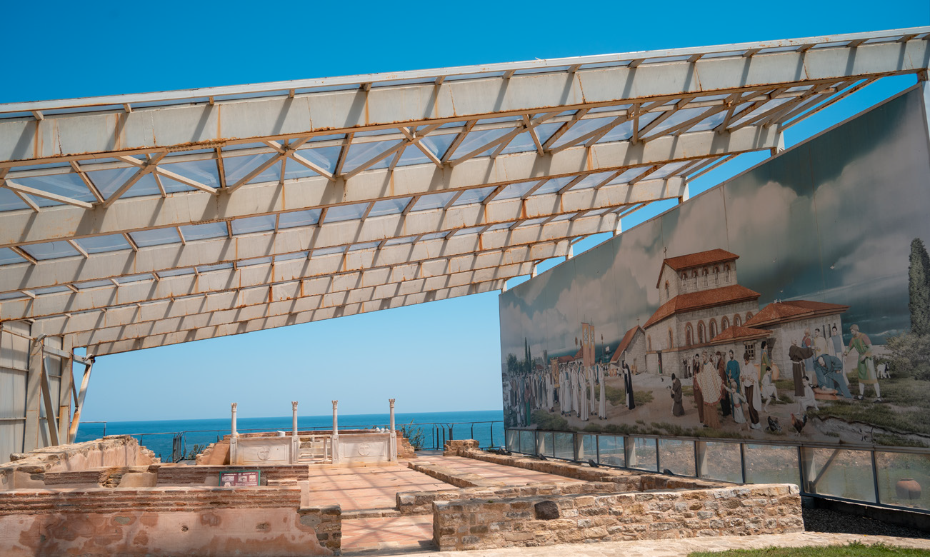
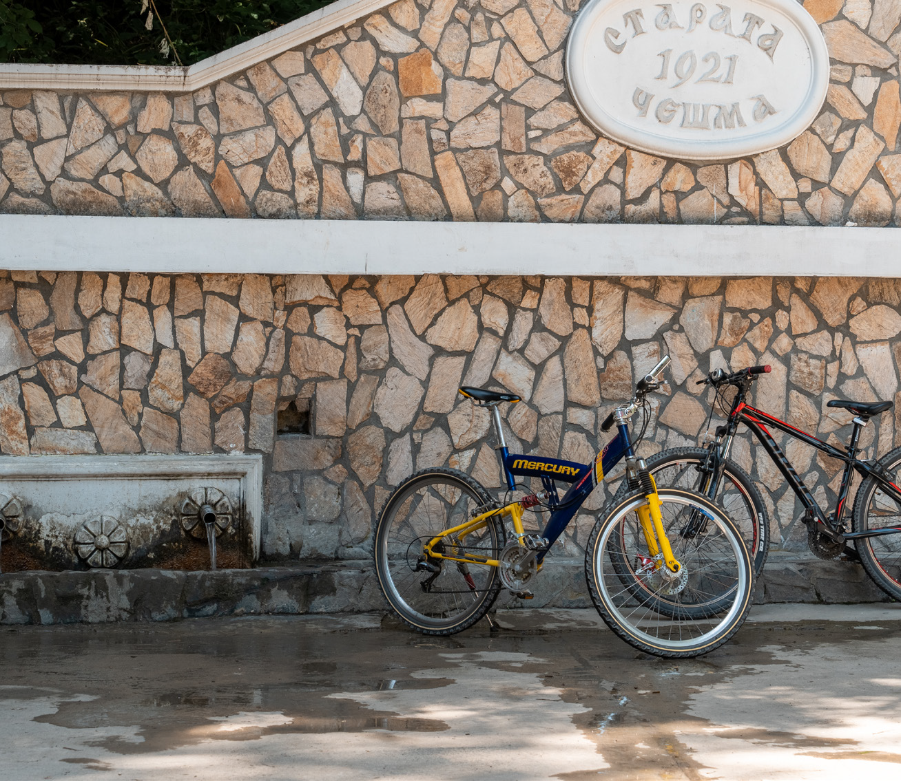
The beginning of the yellow route is the ancient fortress on Cape St. Atanas in the town of Byala, located on the very coast, on Cape St. Atanas, where tourists can learn about the history of the ancient fortress. There is a fountain and a parking lot right next to the starting point, as well as an information centre and a grocery store open for the summer season.
Cape St. Atanas is located between the towns of Byala and Obzor, 3 km south of Byala. It offers beautiful views of the beaches and the sea. The name of the cape comes from Late Antiquity and is associated with St. Athanasius the Great, Patriarch of Alexandria – one of the most prominent theologians and guardians of the purity of the faith. Near the fortress on Cape St. Atanas there is a small bay called Ai Yani, and its beach - Ayana. South of the town of Byala there is another cape - Ingiliz Burun, translated as the English Cape.
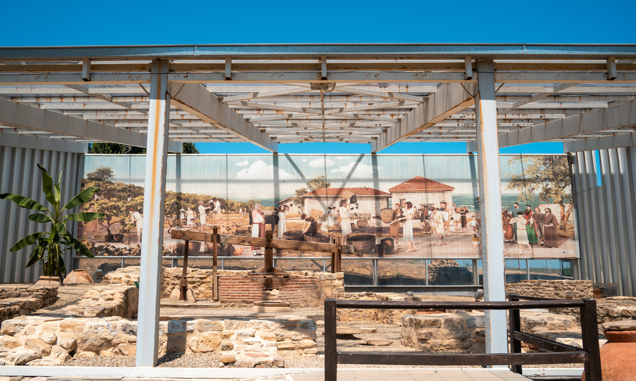
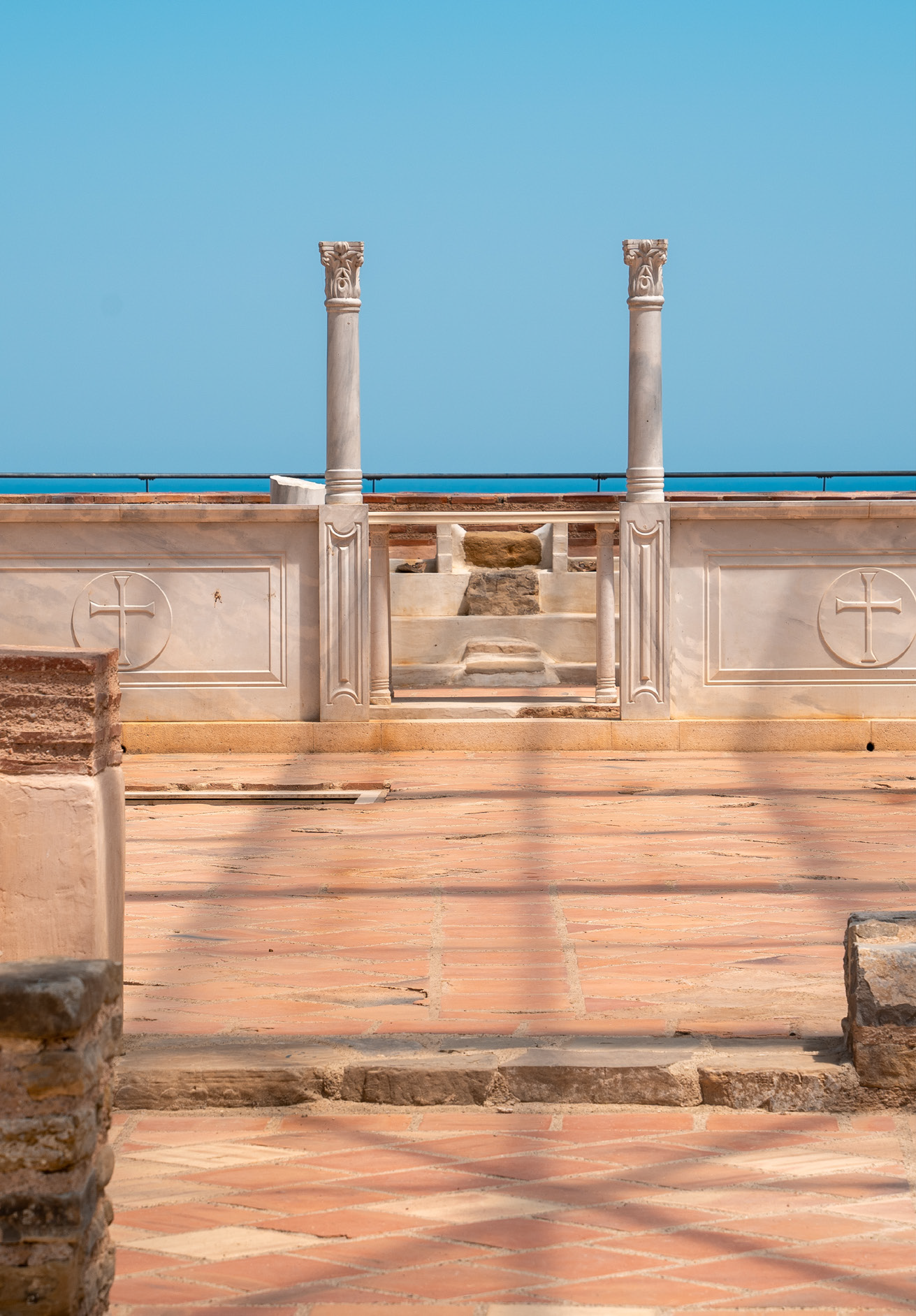
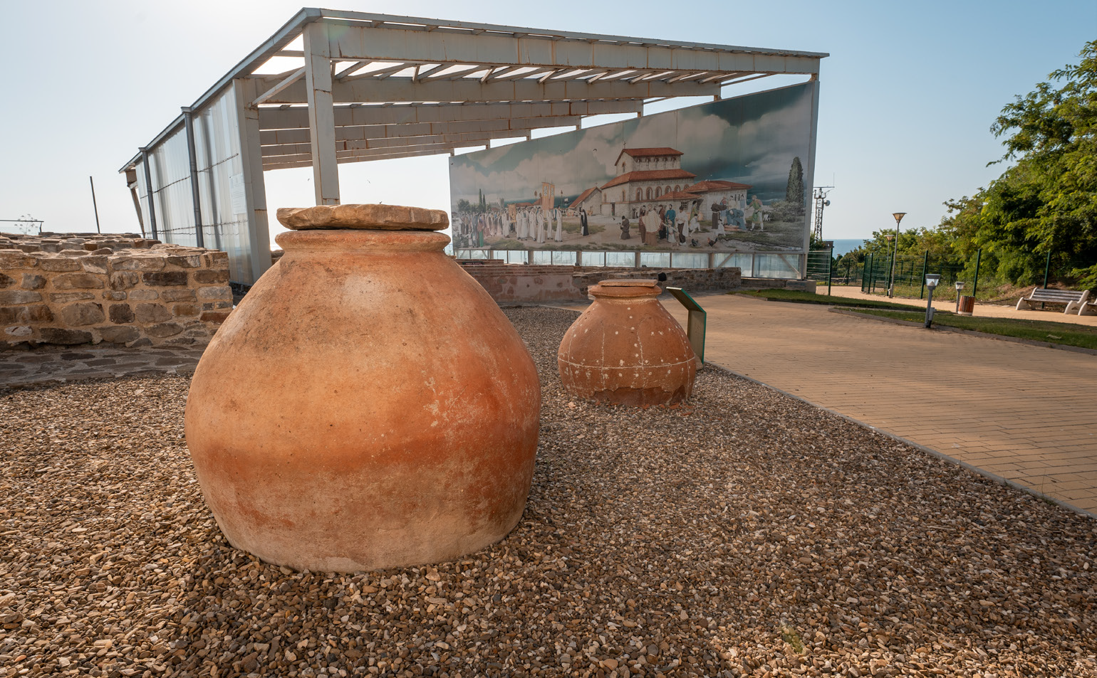
The ancient fortress on Cape St. Atanas is a valuable archaeological find from the Late Antiquity and the Middle Ages. The discovered remains are of high archaeological and historical significance - an early Christian sacral centre, a city bath, a central street, 30 buildings with various purposes, production facilities, three wineries and kilns for household pottery. One of the most remarkable sites in the ancient city is the Basilica, located on the edge of the cliff, which is partially restored. It is an authentic place where history has left its mark and a destination worth visiting.
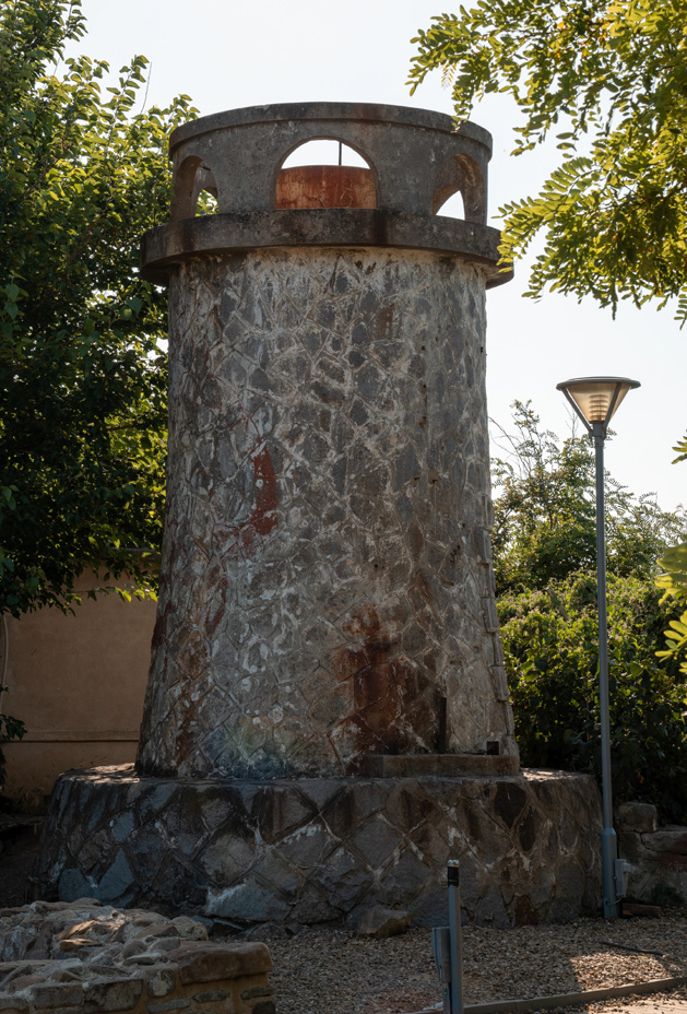
It also offers a picturesque view. In front of the main entrance, there is a large model of the ancient settlement. The beautifully painted panels present a three-dimensional picture of the settlement and scenes from its life and stimulate the imagination of the visitor. The southern part of the fortress is the location of the Lighthouse of Cape St. Atanas, turned into a tourist attraction in the area of the archaeological excavations.
Going north from the ancient fortress, we cannot fail to mention a few interesting places. Between Cape St. Atanas and the town of Byala there is a small bay where the sea throws algae with a characteristic pungent odour. Hence its name – Kokar, meaning ‘smelly’. Here are also Todor’s Rocks – rocks that are dangerous in times of stormy sea because they are difficult to see. Legend has it that the boat of Todor, a fisherman from Byala, capsized here and he drowned in the accident, and that is why they are called Todor’s Rocks.
Continuing along the route, we pass through Shami beach, above which there is a small cape - Shen Kurun, which is the endpoint of a hill of the Kamchia Mountain. One of the meanings of the ancient Greek verb “συγ- κυρέω” is “to border on, to neighbour.” Along the route, we come to the Glyco (Гλυκό) – the mouth of the stream passing through Byala, forming a small freshwater lagoon. According to the legends of the first Greek settlers in the area, who discovered the mouth of the stream, the water was so sweet that they called the place “glyco” (sweet).
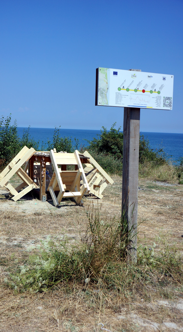
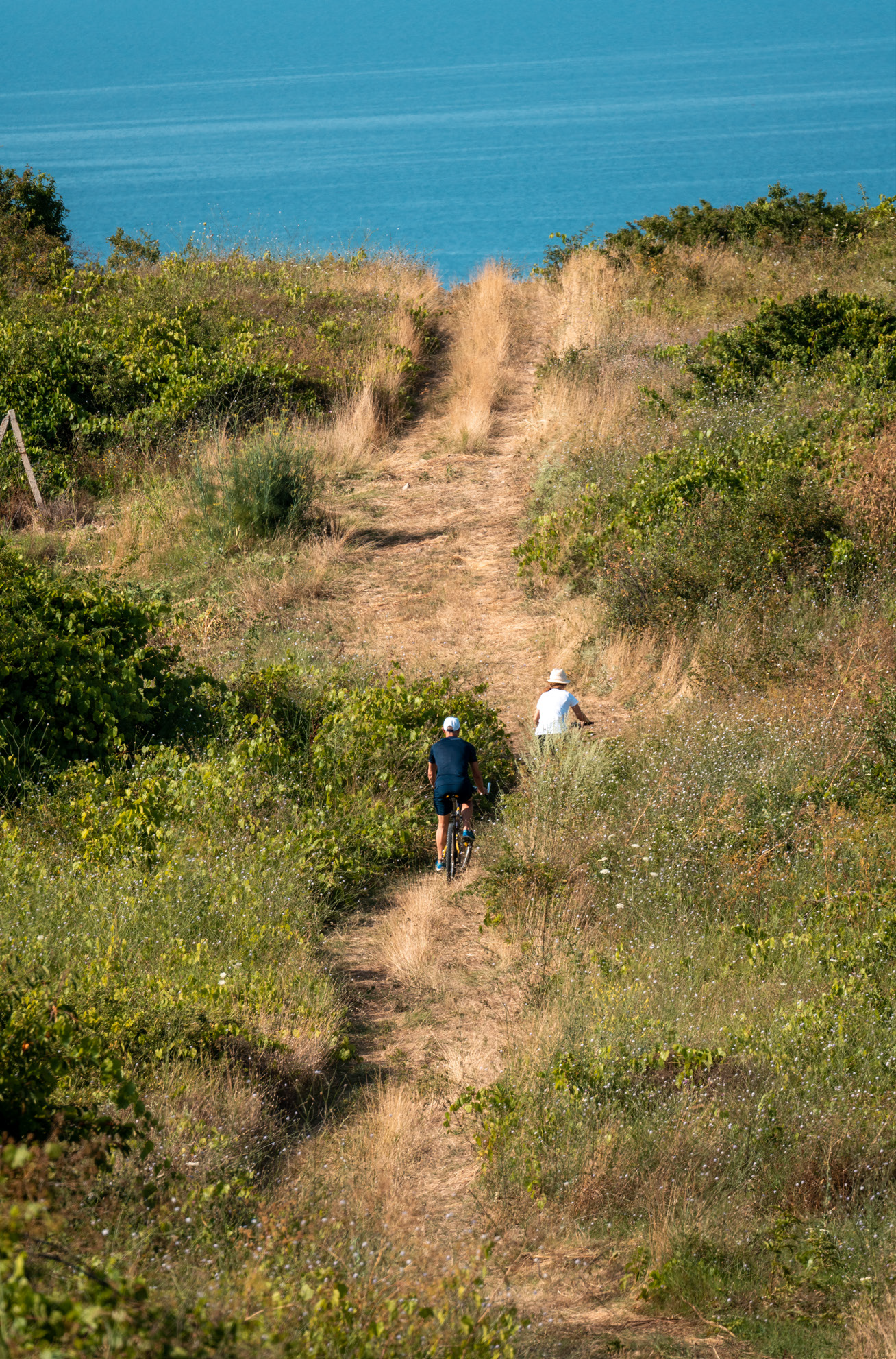
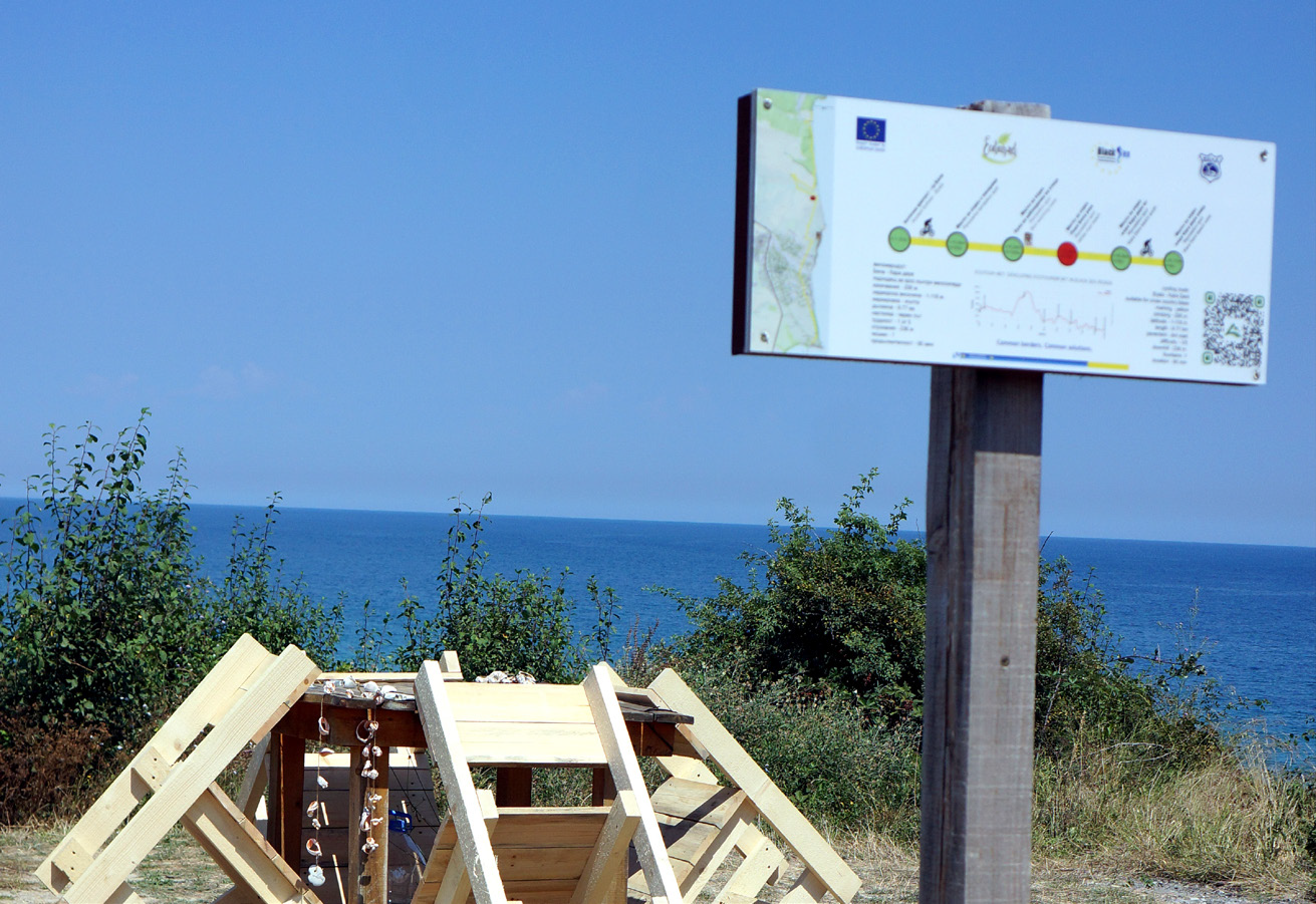
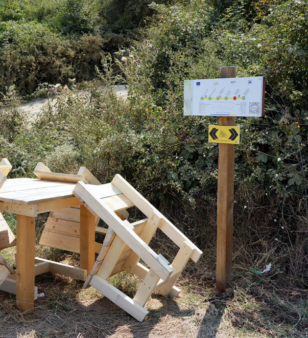
From the model of the fortress, head along the steep road up (north) and after about 160 m (ascent) and a few turns, the terrain is flat again. Only 300 m from the starting point, you arrive at the first place for rest with panoramic sea views, where there is an information board with information about the route. A table and benches made of wood are placed here. The place reveals a wonderful sea view and in addition to relaxation, it can be used for observation and photography of insects and birds, the dance of dolphins, wildflowers and shrubs.
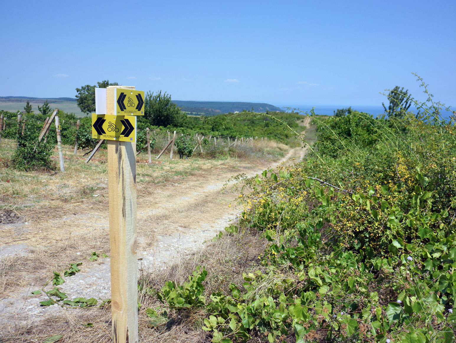
Going forward, the road keeps near the edge of the cliffs, high above the shore. It is advisable to follow the markings on the streets so that there are no deviations in the wrong direction. Now is the time for cyclists to look around for a shop, if they have not secured food and water yet, or, if they have identified a technical problem - to make the short trip to the town centre, where there is a public bicycle repair stand.
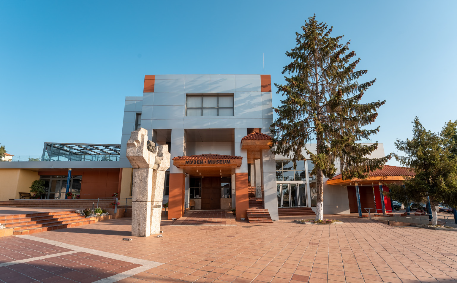
The Municipal Cultural Institute - Museum of Byala is located nearby, which preserves the material cultural and historical monuments discovered during the archaeological excavations of Cape St. Atanas - Thracian cult centre, including 120 cult pits, kilns, dozens of sacrificial hearths and a temple, marble statuettes found in the sanctuary of Heracles from the Roman period of the archaeological site. There is also the Byala and the Sea exposition, which presents amphorae, amphora seals, dishes for eating fish, dishes for preparation and storage of fish, fishing tackle.
It is recommended for lovers of cultural, ethno- cultural, creative and thematic tourism to visit the Ethnographic complex in Byala and enjoy the over 300 exhibits arranged by the Municipality – items of artisanal handicrafts, traditional for the region: knitting, weaving, tailoring, leatherworking, homespun tailoring, cooperage, agriculture, animal husbandry, fishing, viticulture, a traditional room, clothing.
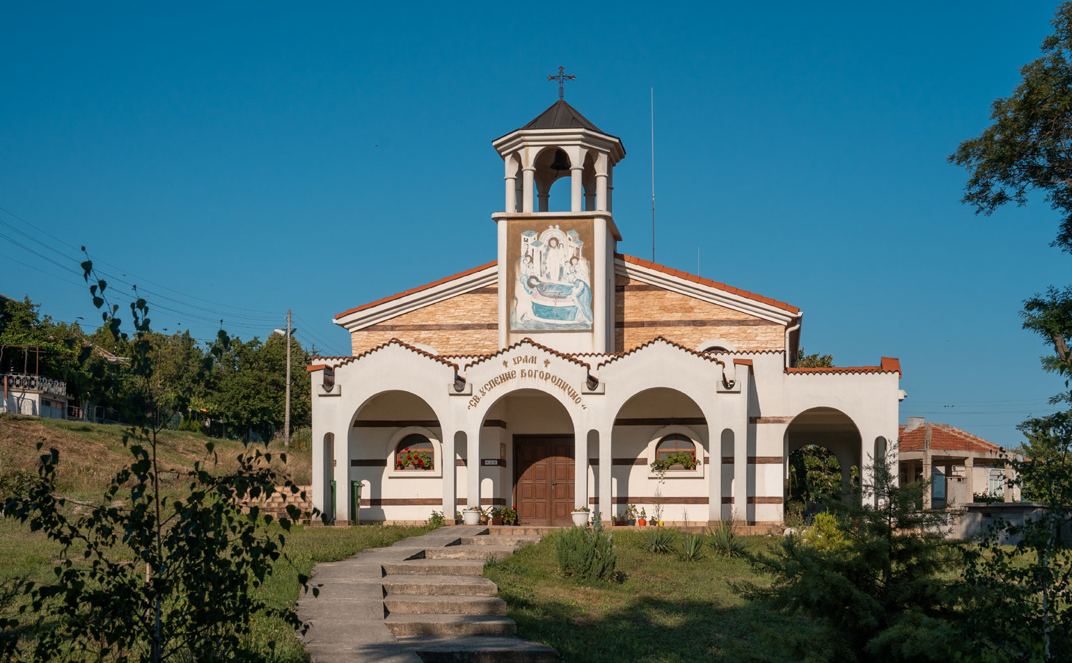
Also of interest are the cultural sites of regional importance - the old churches in the town of Byala – St. Venerable Martyr Paraskeva, the oldest church in the municipality, the Church of the Assumption of the Blessed Virgin, the St. Atanas chapel, defined as the oldest Christian centre in the lands around Byala.
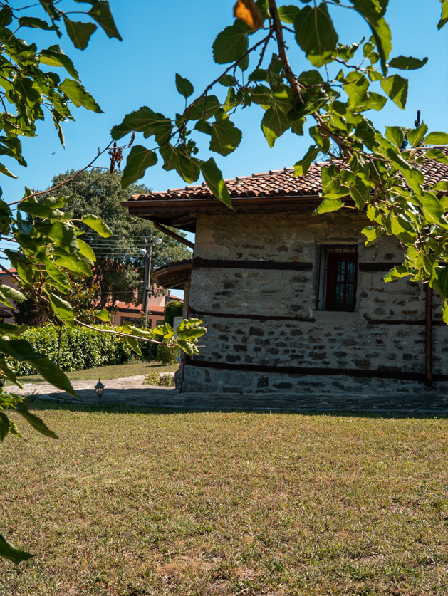
In the White Rocks Demonstration Centre, located in the heart of the town, visitors can view exhibits from the global geological phenomenon White Rocks.
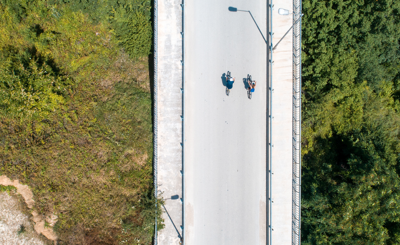
Shortly before leaving the town, you will cross a large bridge, followed by a steep ascent on asphalt and after a short ride on a dirt road, you reach the first viewpoint with panoramic sea views, where there is an information board with information about the route. A table and benches made of wood are provided. The place reveals a wonderful sea view and in addition to relaxation, it can be used for observation and photography of insects and birds, the dance of dolphins, wildflowers and shrubs.
Here is the Birdwatching Tower – the third waypoint on the Red Route. The birdwatching tower offers an incredibly beautiful panoramic view of Cape St. Atanas and the Black Cape. This is where the Via Pontica flyway passes – one of the main bird migration routes from Europe to Africa. It is of international importance as a typical “narrow-front migration corridor” for migratory birds: 78% of all white storks (Ciconia ciconia), the entire population of rosy pelican in Europe (Pelecanus onocrotalus), Egyptian and griffon vulture (Neophron percnopterus), the rare Eastern imperial eagle species, other birds of prey, waterfowl and songbirds. Migratory birds concentrate and cross the Balkan Mountains through this part, because it is the lowest and easiest to overcome barrier.
Birdwatching can take place at any time of the year. Spring is a very favourable season. The migration flights are mainly in the morning, but some species fly over at night. Trips in the early morning under the guidance of experienced specialists are recommended. The flights of the typical for the territory redbacked shrikes, pied and isabelline wheatear, European shag, alpine swifts, rosy starlings, calandra and greater short-toed larks, cranes can be watched from the tower.
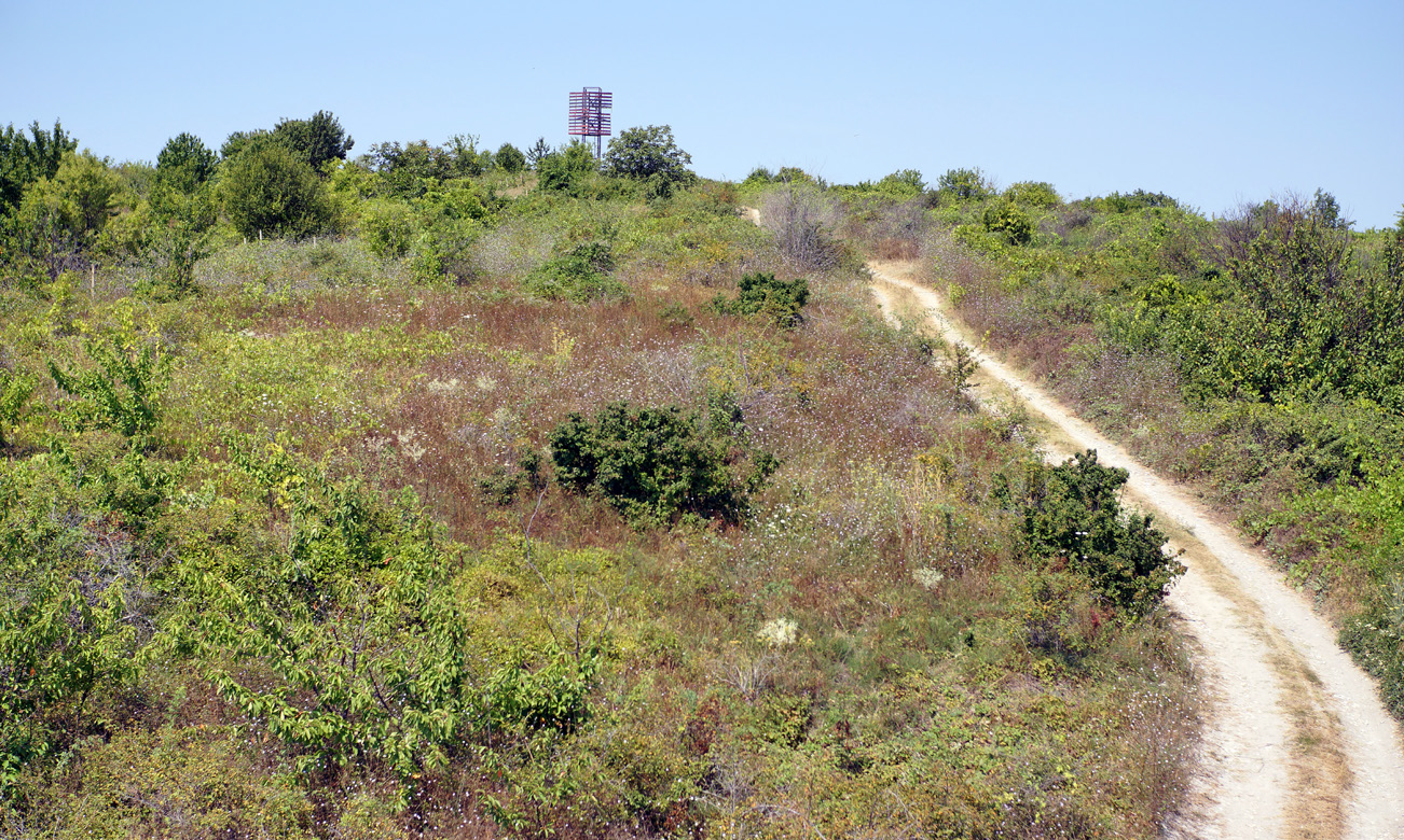
The route continues on dirt roads surrounded by bushes - mainly hawthorn (Crataegus monogyna), dog-rose (Rosa canina), blackberry (Rubus), dogwood (Cornus mas), blackthorn (Prunus spinosa), free-growing near villages and paths, on steep slopes and desolate lands, numerous beautiful and colourful grassy species - coltsfoot (Tussilago farfara), deadnettle (Lamiaceae Labiatae), shepherd’s purse (Capsella bursa pastoris), wall barley (Hordeum murinum), representatives of the Bromus genus, lesser celandine (Ficaria verna). During the ride, typical birds inhabiting the settlements and villa areas can be observed – robin (Erithacus rubecula), Eurasian wren (Troglodytes troglodytes), common chaffinch (Fringilla coelebs), great tit (Parus major), blue tit (Cyanistes caeruleus), black redstart (Phoenicurus ochruros), common redstart (Phoenicurus phoenicurus), house martin (Delichon urbicum), the common swift (Apus apus).
If you listen carefully, you may hear “song” of the blackbird (Turdus merula), the “laughter” of the green woodpecker (Picus viridis) and the knocking of the great spotted woodpecker (Dendrocopos major).
As soon as the herbaceous plants bloom, the first insects appear – honeybees and bumblebees, ladybirds (Coccinella septempunctata), American painted lady (Vanessa virginiensis), small tortoiseshell (Aglais urticae), blackleg tortoiseshell (Nymphalis polychloros), mourning cloak (Nymphalis antiopa).
The localities north between Byala and the seashore are called Bulaskara and Fithes. We must also mention Demir burun – the Iron Cape along our route. The cape is located north of the town of Byala and is so named because there were manganese ore mines above it. There are two fountains in the area - Kundilaki fountain and Yalam fountain, probably built according to the old custom of „commemoration and good fortune” and are named after the people who built them.
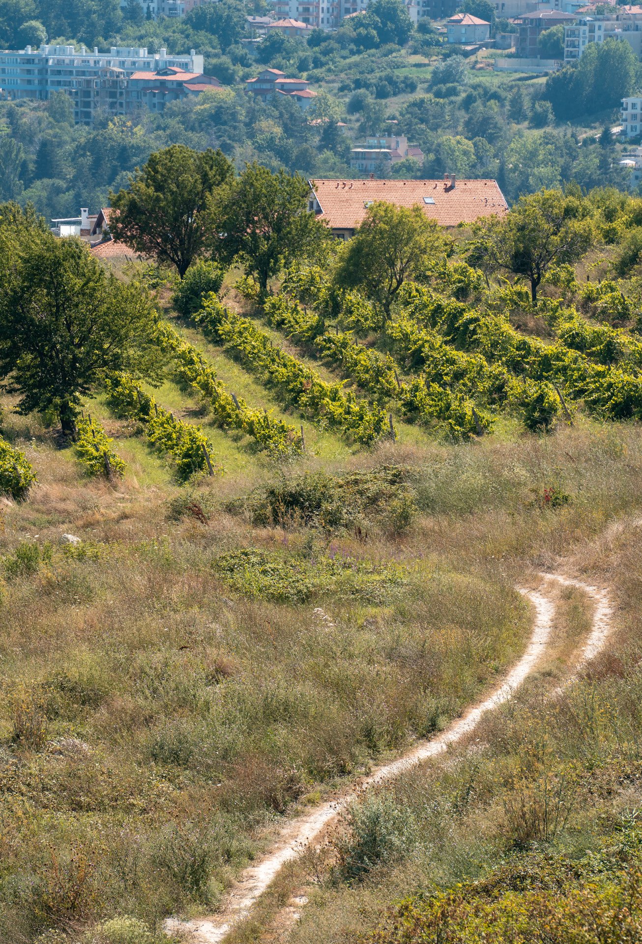
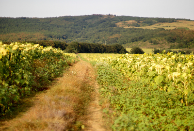
After the Tower, the route ascends some more (westward) and after 240 m it turns right, starting the descent. After about 200 m the slope becomes quite steep, and considering the terrain and some sharp turns it is not recommended to ride with high speed. After the three sharp turns the road goes on straight only, passes through large vineyards – as far as the eye can see there are vast areas planted with vines - Saye ambeli – vineyards around the livestock pen.
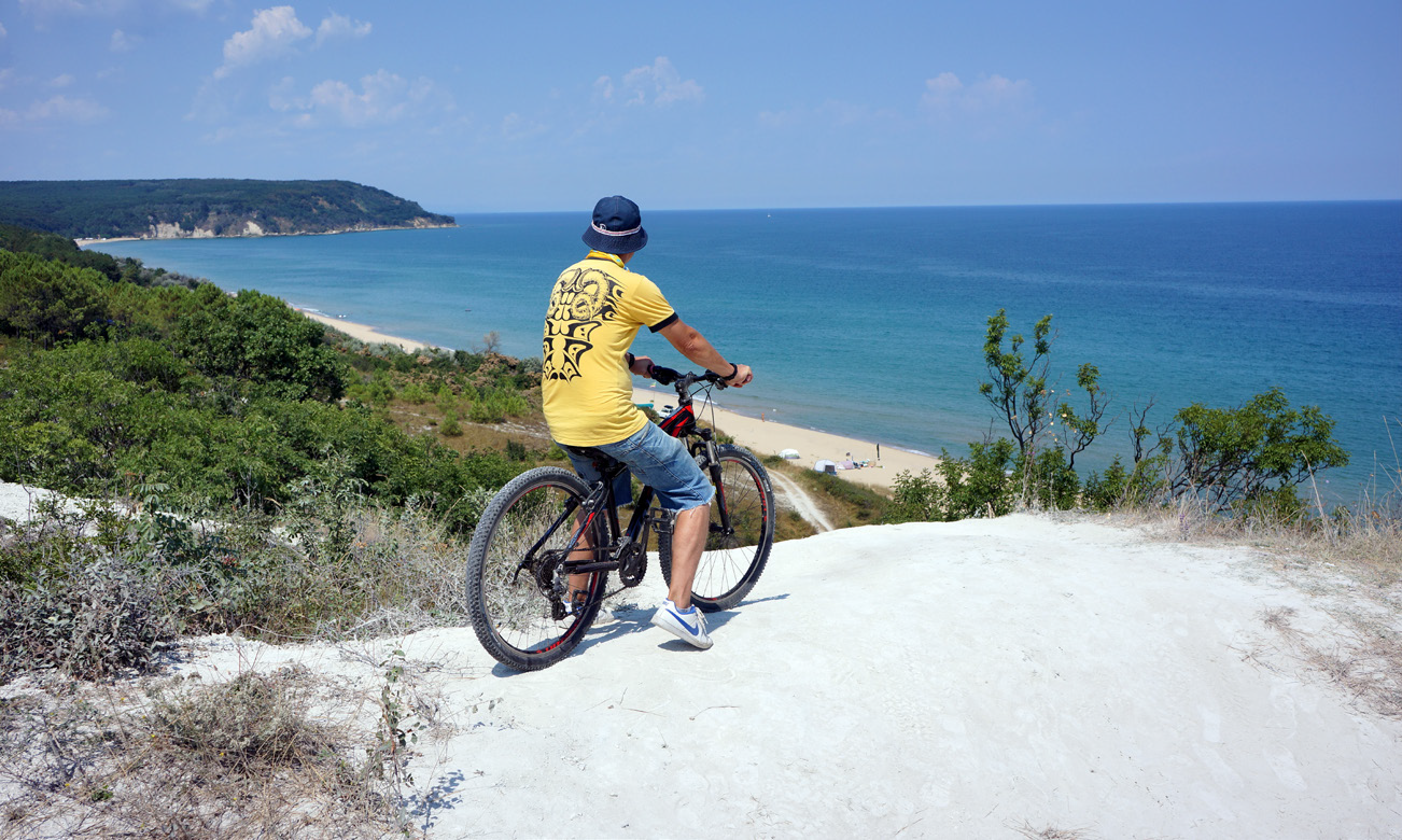
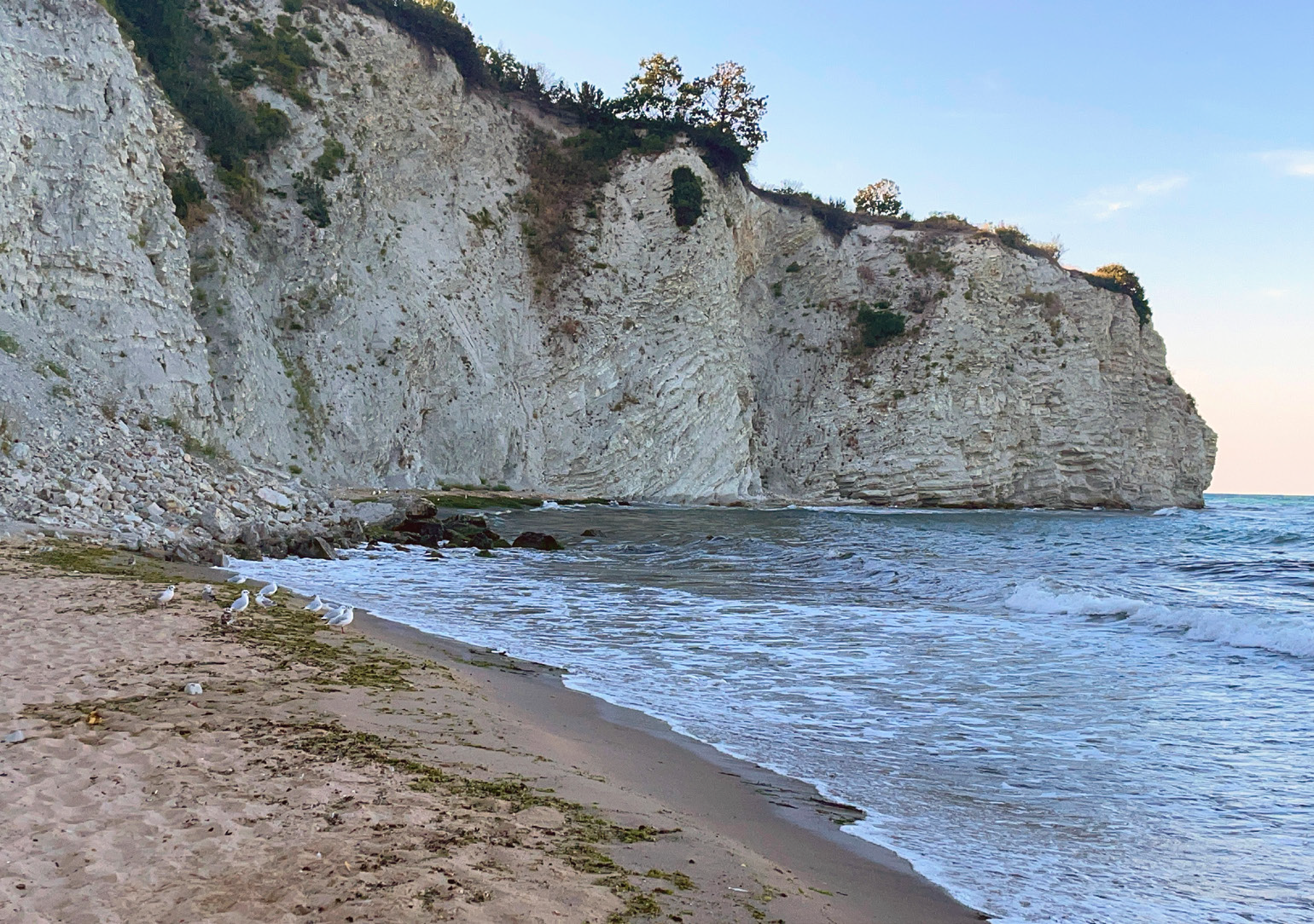
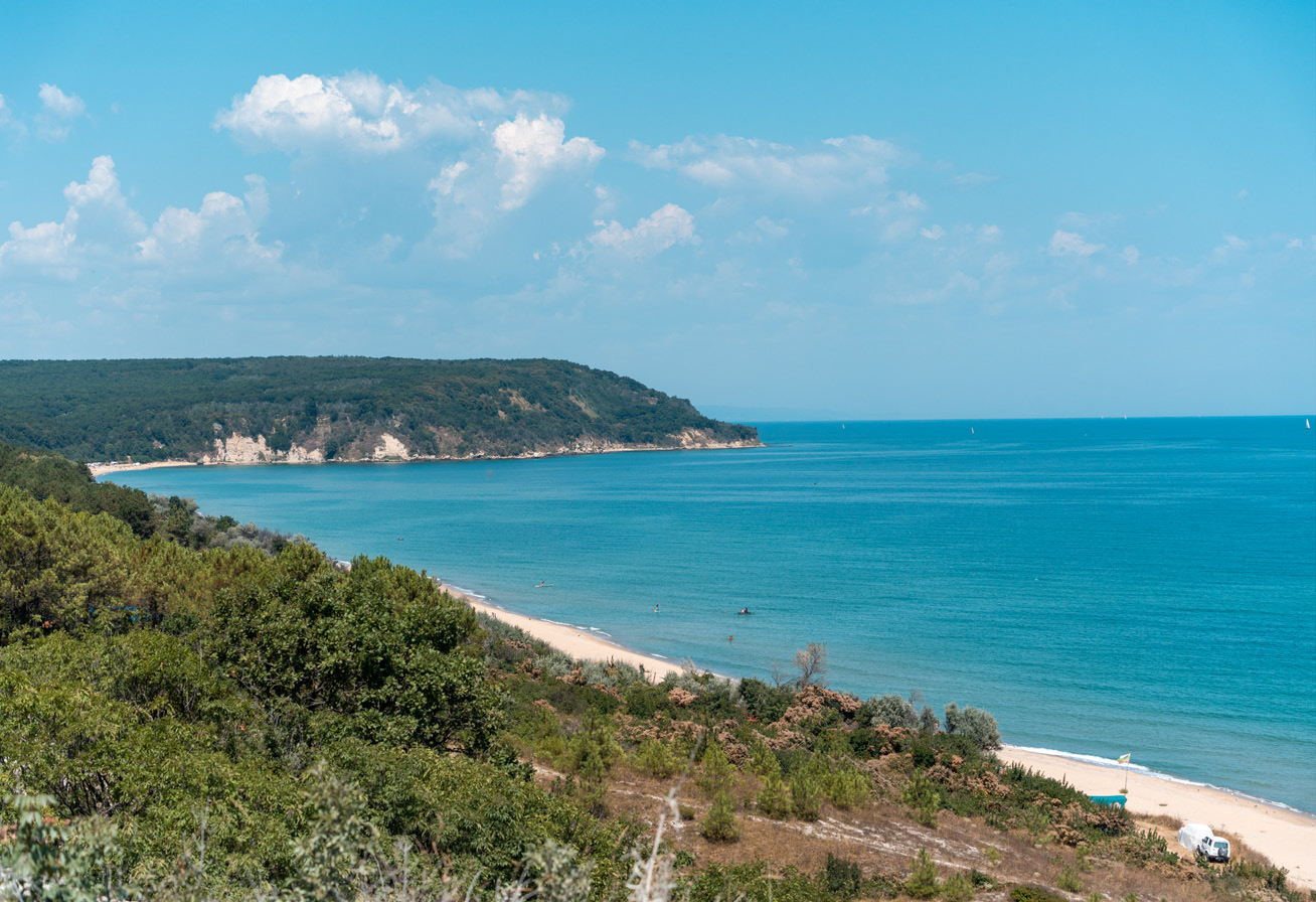
We have now reached the area of the natural landmark “White Rocks”. The natural landmark “White Rocks” has a total area of 14.5 ha. Some 65 million years ago (Cretaceous/ Tertiary) a meteorite collided with the Earth (in the Gulf of Mexico) and caused the extinction of the dinosaurs. At that time, the territory of today’s town of Byala, located 10,000 km from the site of the collision, was at the bottom of a large sea at a depth of about 300 meters. Today, now above sea level, the White Rocks are one of the four places in the world (and the only one accessible) that testify to this cataclysm. They represent a two-kilometre continuous geological rocky profile in which the two consecutive Cretaceous/Tertiary periods are clearly marked. The rocks are high in clay, light grey in colour, in places almost white, with imprints of marine life and algae, slightly curving, forming small bays.
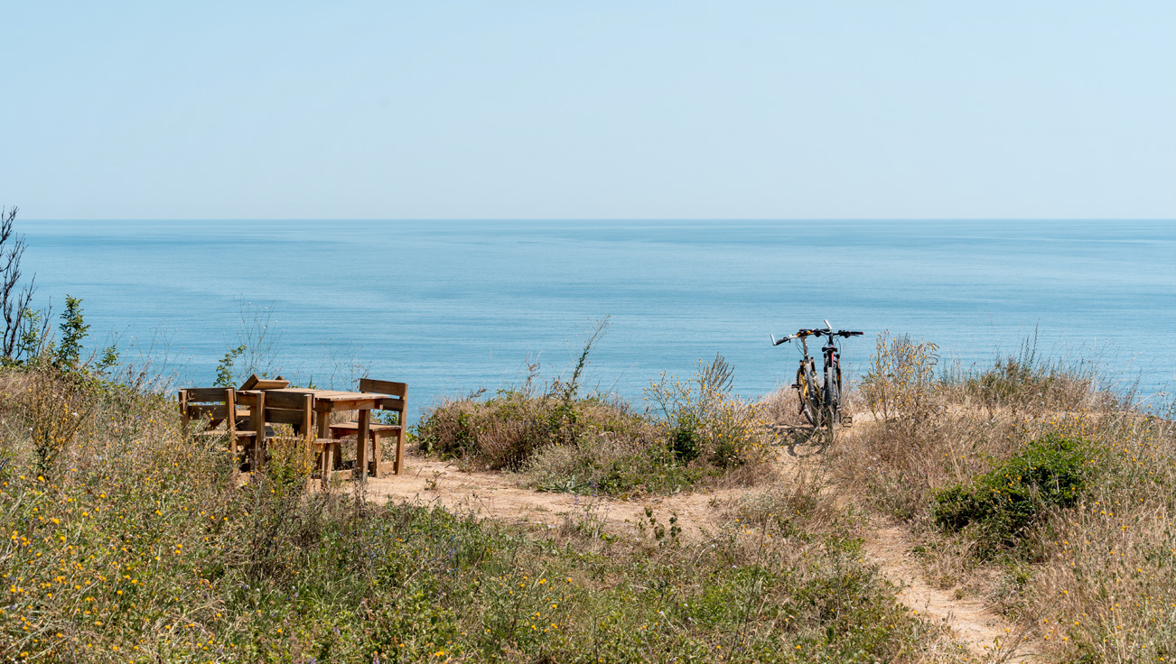
In a few minutes, the road leads to the third place for rest with panoramic views, which is only 70 meters from the sea. On a spacious meadow there is a place for rest with a wonderful panoramic view overlooking the Karadere beach – perhaps the last genuinely wild beach and one of the longest on the Bulgarian Black Sea coast. Here you can take panoramic photos and a short break before the forthcoming descent to the gorge of the river Byala Reka. A table and benches made of wood have been placed here.
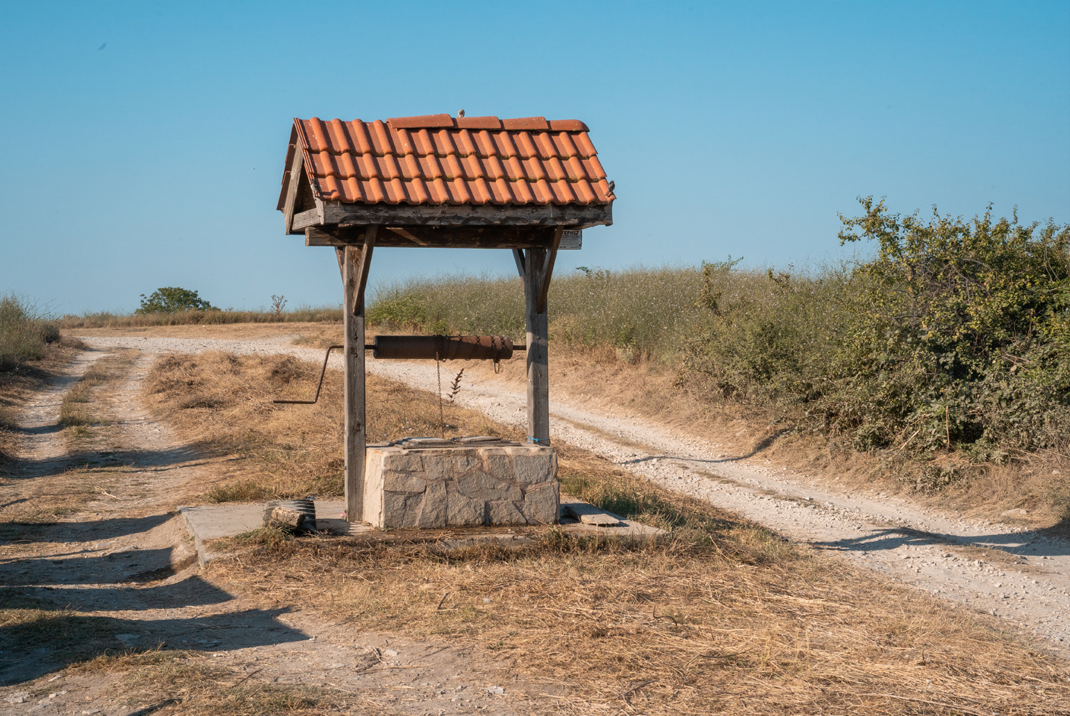
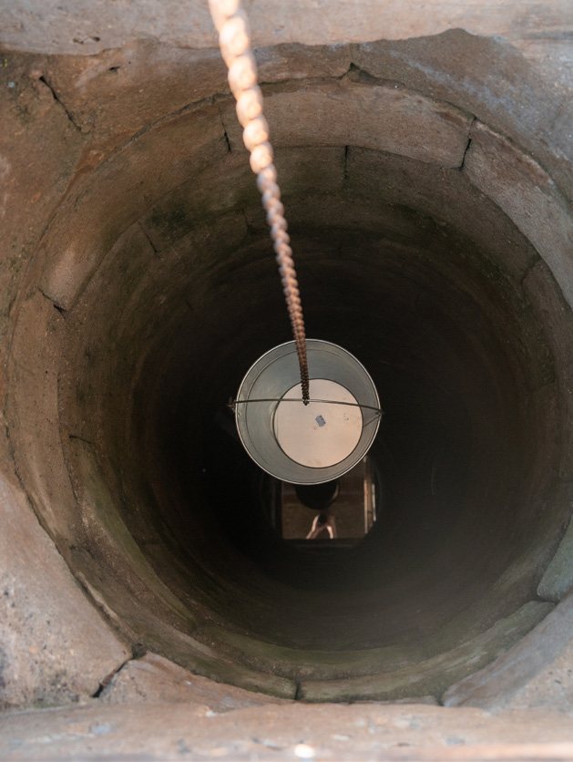
After the place for rest you take the road to the left, and after 650 m you take a right turn to the road passing through the gorge. Shortly before climbing up to the top, on the left side of the opposite slope is the only fountain along the route – the Aleksa fountain, but you should not rely entirely on it, as it dries up in dry periods.
Passing through the arable land along the route (vineyards), you can see common species of birds of prey, such as common buzzard (Buteo buteo), and also rosy starling (Sturnus roseus), greenfinch (Carduelis chloris), great spotted woodpecker (Dendrocopos major), jay (Garrulus glandarius), red-backed shrike (Lanius collurio), robin (Erithacus rubecula), golden oriole (Oriolus oriolus).
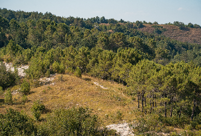
Passing through artificially afforested coniferous species, you can see black pine (Pinus nigra), European red pine (Pinus sylvestris) and, less commonly, spruce (Picea abies) and silver fir (Abies alba). In some places, there is afforestation with maritime pine (Pinus pinaster), Atlas cedar (Cedrus atlantica) and Lebanese cedar (Cedrus libani). These pine forests with sandy soil are home to large numbers of some species of edible mushrooms – Slippery Jack (Suillus) and less often penny bun (Boletus), chanterelle (Cantharellus cibarius) and honey fungus (Armillaria mellea).
A few meters from the Aleksa fountain, there is a fork where you have to make an almost U-turn to the right and ride alongside the edge of the field, go around an orchard and then again alongside the edge of the field you will reach a section that runs parallel to the sea.
Some 50-60 m after reaching a smooth left turn, take the road to the right, which descends to the beach. It is steep and quite technical, so be extra careful!
After coming down, continue along the path parallel to the sea. It has slight ascents and descents, and the coniferous trees and the landscape are very reminiscent of the Mediterranean.
After 1.4 km the route reaches a small parking space – a meadow with a place for rest, where the road turns left, then right and crosses the river. Then it again turns right to the sea and after 460 m you reach the information board on the beach, which is the end of the route and the last place for rest. If you will be using mobile navigation devices, keep in mind that there is no cellular coverage in the Karadere area.
Along the way you will encounter formations consisting of white poplar (Populus alba), black alder (Alnus glutinosa) and white willow (Salix alba), characteristic of the *91E0 habitat, as well as climbing plants such as Old Man’s Beard (Clematis vitalba) and common ivy (Hedera helix).
Here you can hear the croaking of the common water frog (Pelophylax esculentus), spot the common wall lizard (Podarcis muralis), the great crested newt (Triturus cristatus), the European pond turtle (Emys orbicularis) and the otter INidrata (Lutra lutra).
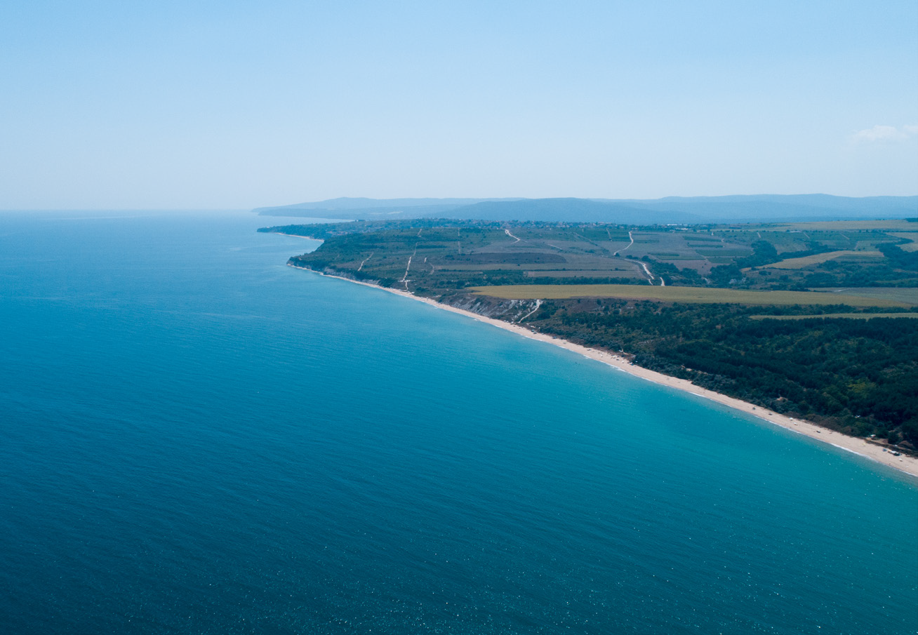
Karadere beach is one of the longest beaches on the Bulgarian Black Sea coast. The route runs parallel to the beach and in places borders a forest, elsewhere shrubs.
The main plant species inhabiting the unstabilized sands are sea holly (Eryngium maritimum), also called seaside eryngo, European searocket (Cakile maritima), sea spurge (Euphorbia paralias), sea kale (Crambe maritima), rhizome cereal species, such as mammoth wild rye (Leymus racemosus) and marram grass (Ammophila arenaria). Closed plant communities are formed on the stabilized sands, dominated mainly by field wormwood (Artemisia campestris), clematis (Cionura erecta), mosses and lichens. The wetland plants - common reed (Phragmites australis) and bulrush (Typha), which grow at the mouth of the river and sometimes reach a height of 3 meters, offer waterfowl good conditions for nesting and shelter.
The name comes from Black Cape as “opposition” to the “white” names to the south. The Black Cape protrudes into the Black Sea between Cape Galata and Cape St. Atanas. It is located about 3.5 km south of the mouth of Shkorpilovska river. Its altitude is about 80 m and it is built of sandstones, its slopes are steep and terraced by landslides. The original Greek name of the Black Cape is Mavro Molo, the Turkish - Kara burun - Kara burun.
The characteristic psammophytic vegetation can be observed on the sandy beaches and dune complexes, which includes both open grass phytocenoses, with sparse vegetation near the shore, and grass communities on the stabilized dunes.
“Kara” is a Turkish word and besides “black”, it also means “bad, fierce, coarse”. South of the mouth of the Kamchia River, opposite Kara Burun, an underwater rock has stranded many ships. Over time, a kind of a sea graveyard has formed there. During the First World War, Varna Bay and the Varna coast were mined for protection. Legend has it that there is a sunken treasure from Turkish ship around the Black Cape. However, there is no scientific evidence for this.
The wonderful natural landmarks of the territory make the route attractive to lovers of phototourism, eco-tourism, hiking, cognitive tourism, research tourism and thematic tourism.
Place For Rest With Panoramic Views - Villa Zone
After crossing the town of Byala and a short ride on a dirt road – about 300 m, you arrive at the first viewpoint with panoramic sea views, where there is an information board with information about the route – waypoint 2. A table and benches made of wood are placed here. The place reveals a wonderful sea view and in addition to relaxation, it can be used for observation and photography of insects and birds, the dance of dolphins, wildflowers and shrubs.
Place For Rest With Panoramic View - Above Byala Reka Beach
Reaching the mouth of the river Byala Reka, on a spacious meadow above it there is a place for rest with a wonderful panoramic view overlooking the Karadere beach – waypoint 5. Here you can take panoramic photos and a short break before the forthcoming descent to the gorge of the river Byala Reka. A table and benches made of wood have been placed here.
Aleksa Fountain
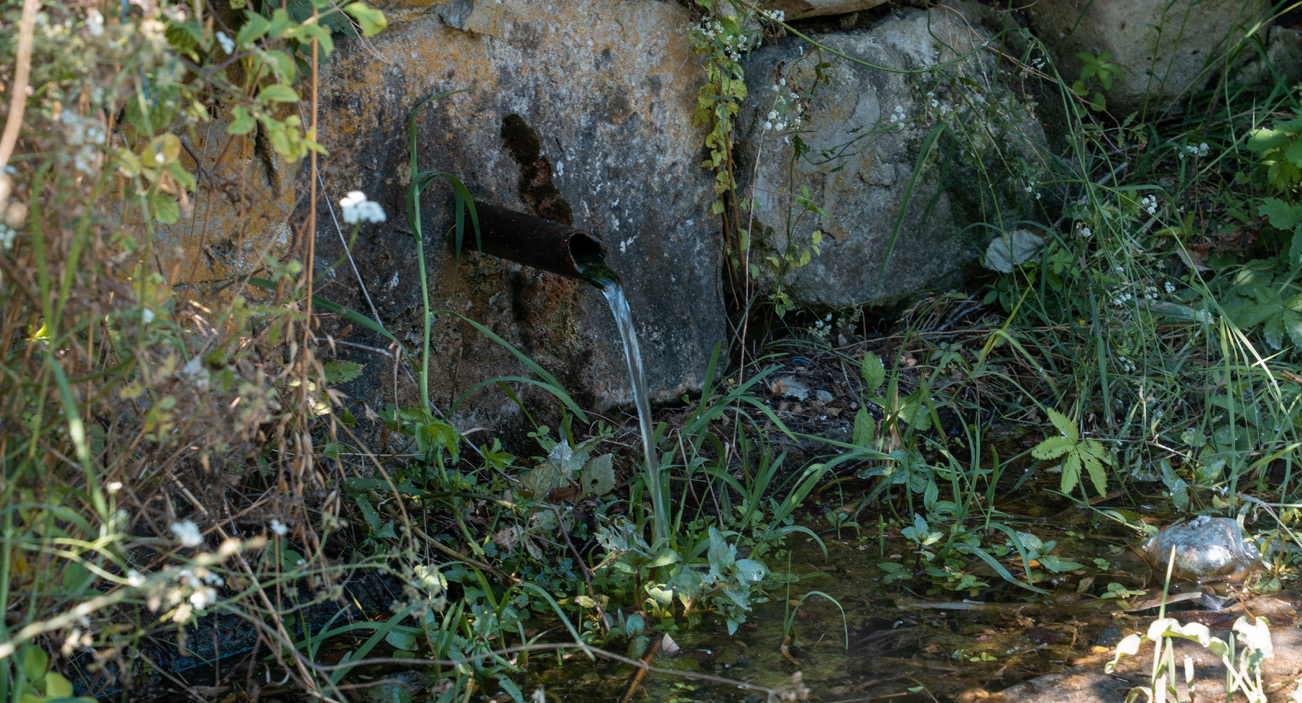
A long and smooth descent leads to the bed of the river Byala Reka. The crossing of the river Byala Reka is one of the difficult parts, but in most cases, when the ground is dry, it is not a problem.
There is a fountain on the northern slope of the gorge, where cyclists and eco-tourists can refresh themselves before continuing.
Karadere South Beach
Karadere beach is the last genuinely wild beach and one of the longest on the Bulgarian Black Sea coast.
The route runs parallel to the beach and in places borders a forest, elsewhere shrubs. Amidst the pristine natural environment, there is a place for rest.
Karadere North Beach
The end point of the yellow cycling route is Karadere beach north. Here is the end point of the yellow route and the start point of the blue route.