Bicycle Red Route
Posted by : BGadmin@ecotournet.net on 20.Sep.21
Last update by : BGadmin@ecotournet.net on 30.Oct.21
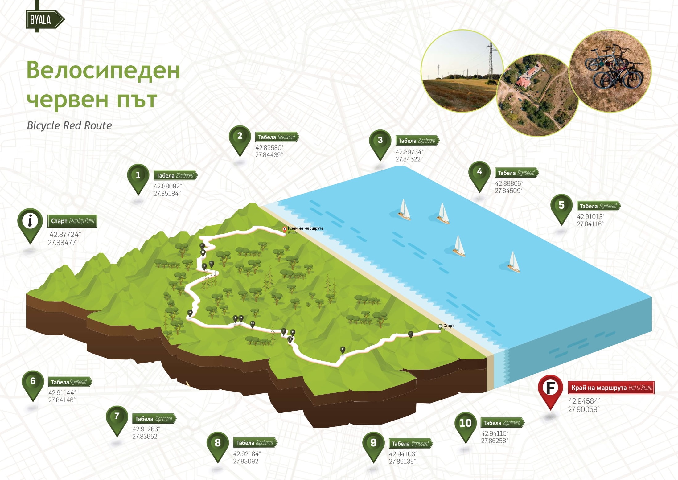
Information on Route
Total distance 20.3 km one way
Elevation gain 284 m
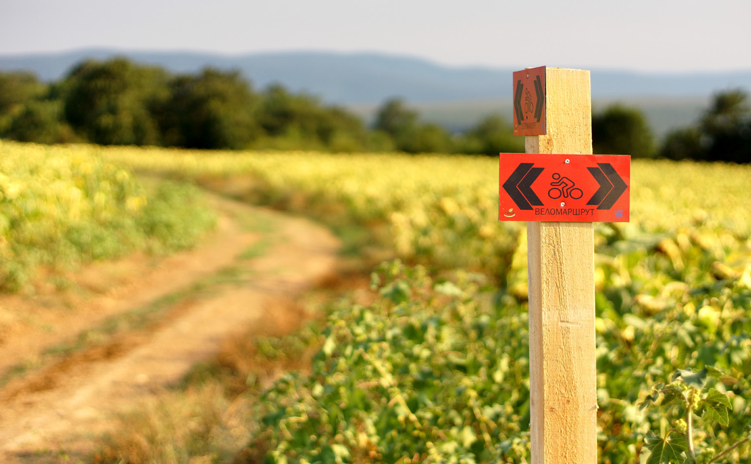
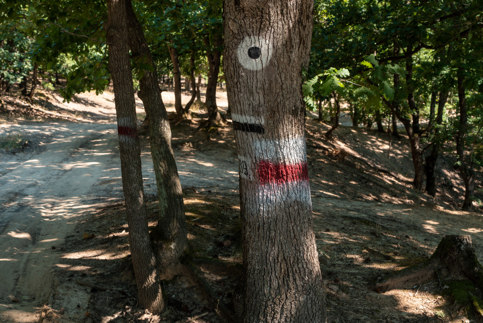
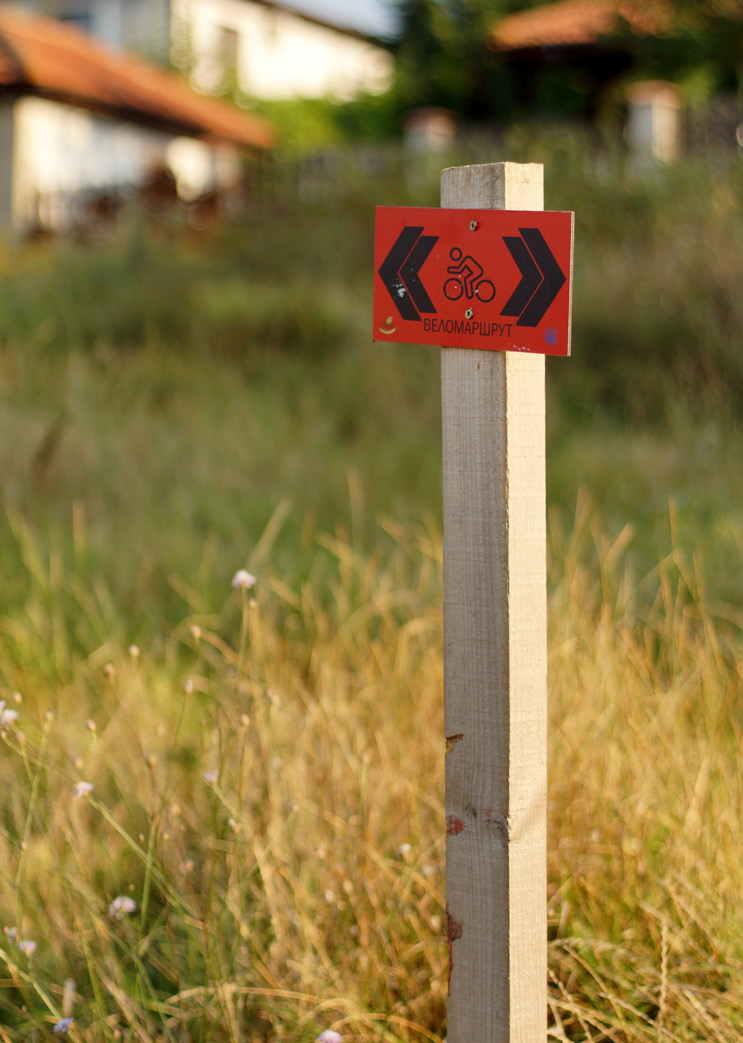
Marking Red
Surface Dirt road, Asphalt
Level of Difficulty from 2 to 5
Technical Difficulty from 1 to 5
Points of interests Centre of the town of Byala > Ecopark Enika > Place for rest on the forest road to the village of Goritsa > Yurta fountain, village of Goritsa, Fountain > Forest road > Place for rest > Lands around the village of Samotino > Place for rest on the forest road to the Village of Samotino > Village of Shkorpilovtsi, Villa zone Ticha > Place for rest > Beach of Shkorpilovtsi resort.
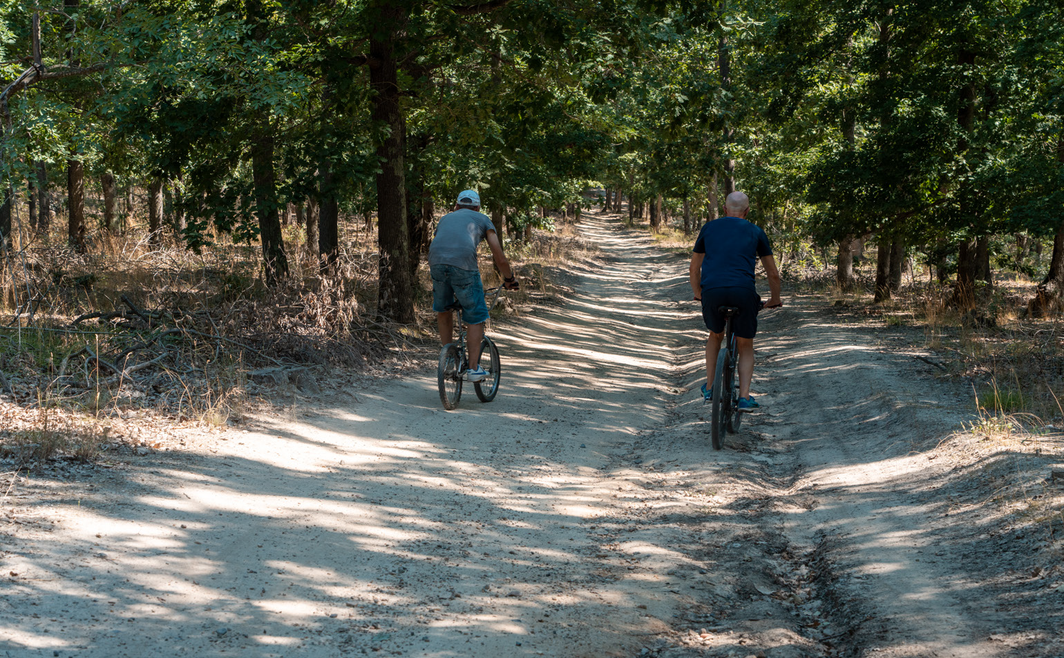
The red route for cycling and hiking is characterized by favourable conditions of the cycling trail and sections requiring higher exertion for lovers of extreme experiences, with a variety of natural landmarks, flora and fauna in the surrounding forests, fields, agricultural areas, waterbodies and rivers, a lake and the existing infrastructure of the town of Byala, ecopark Enika, the surrounding villages Goritsa, Samotino and Shkorpirovtsi, Shkorpilovtsi Resort.
The route is an opportunity for a pleasant trip across the slightly hilly terrain of the easternmost parts of the Pre-Balkan Mountain region. The light terrain and the well-chosen route feature beautiful panoramic views, forests and fields, and the journey will lead you to one of Bulgaria’s best beaches. You will be able to feel the local rural atmosphere passing through the villages of Goritsa and Shkorpilovtsi, visiting their churches, as well as through the smallest village in Bulgaria - Samotino.
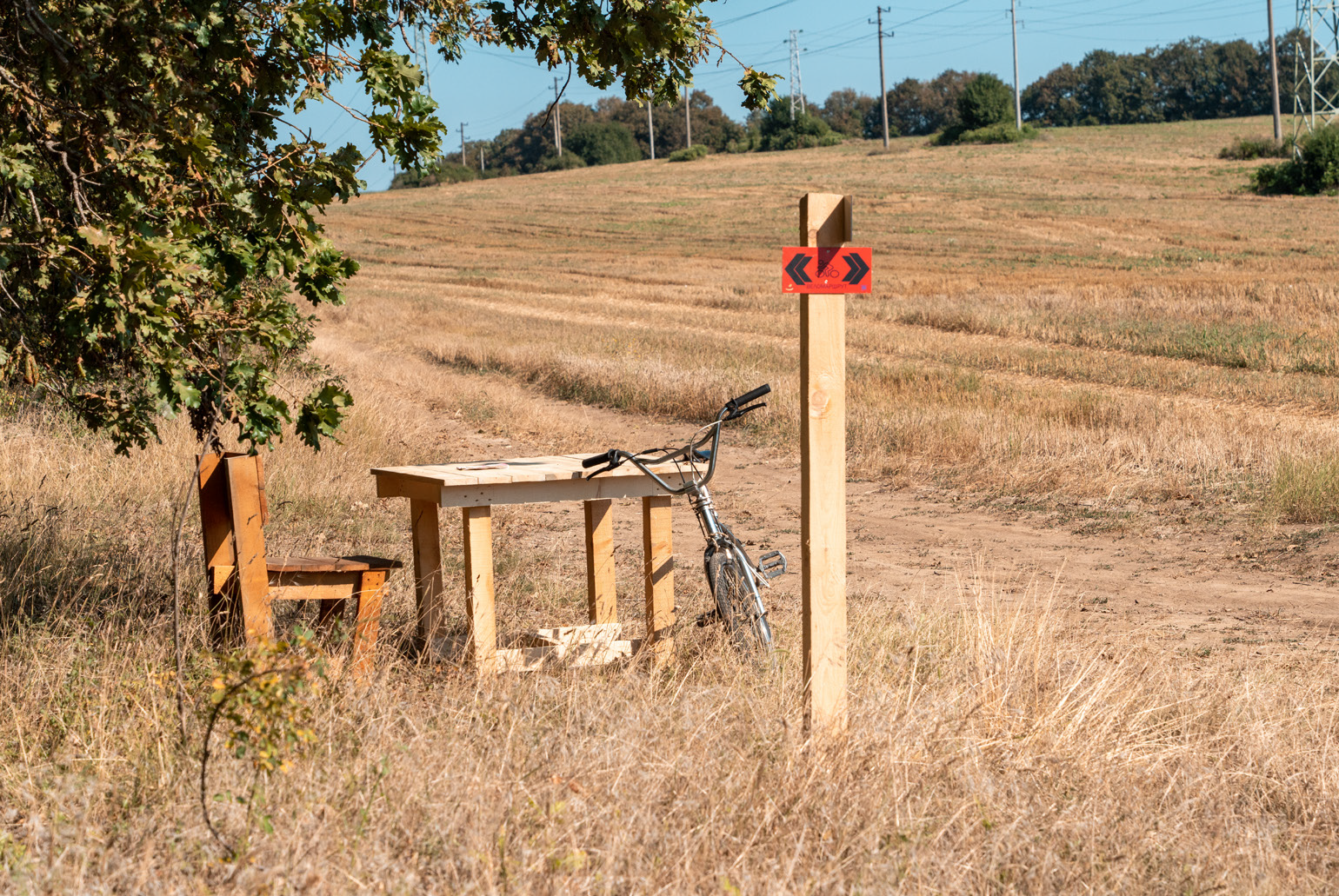
Along the route, there are plenty of fountains and places to eat, as well as four places for rest and picnics. If cyclists wish to add beautiful sea views to their experience and return by a different route, they can take the connecting section to the coastal route to Karadere, which will lead them back to the town of Byala, and then to its ancient fortress.
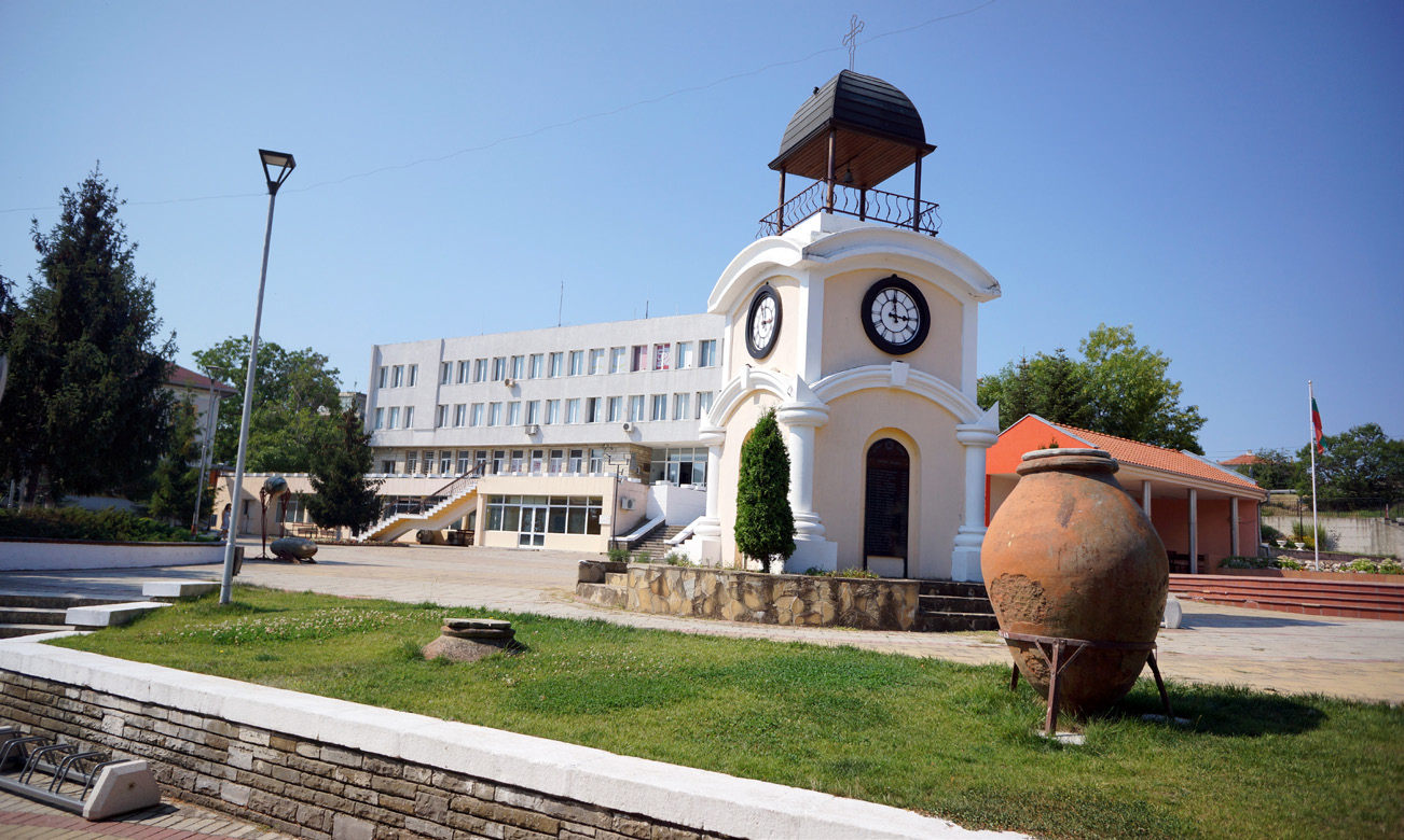
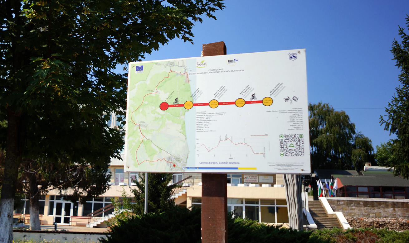
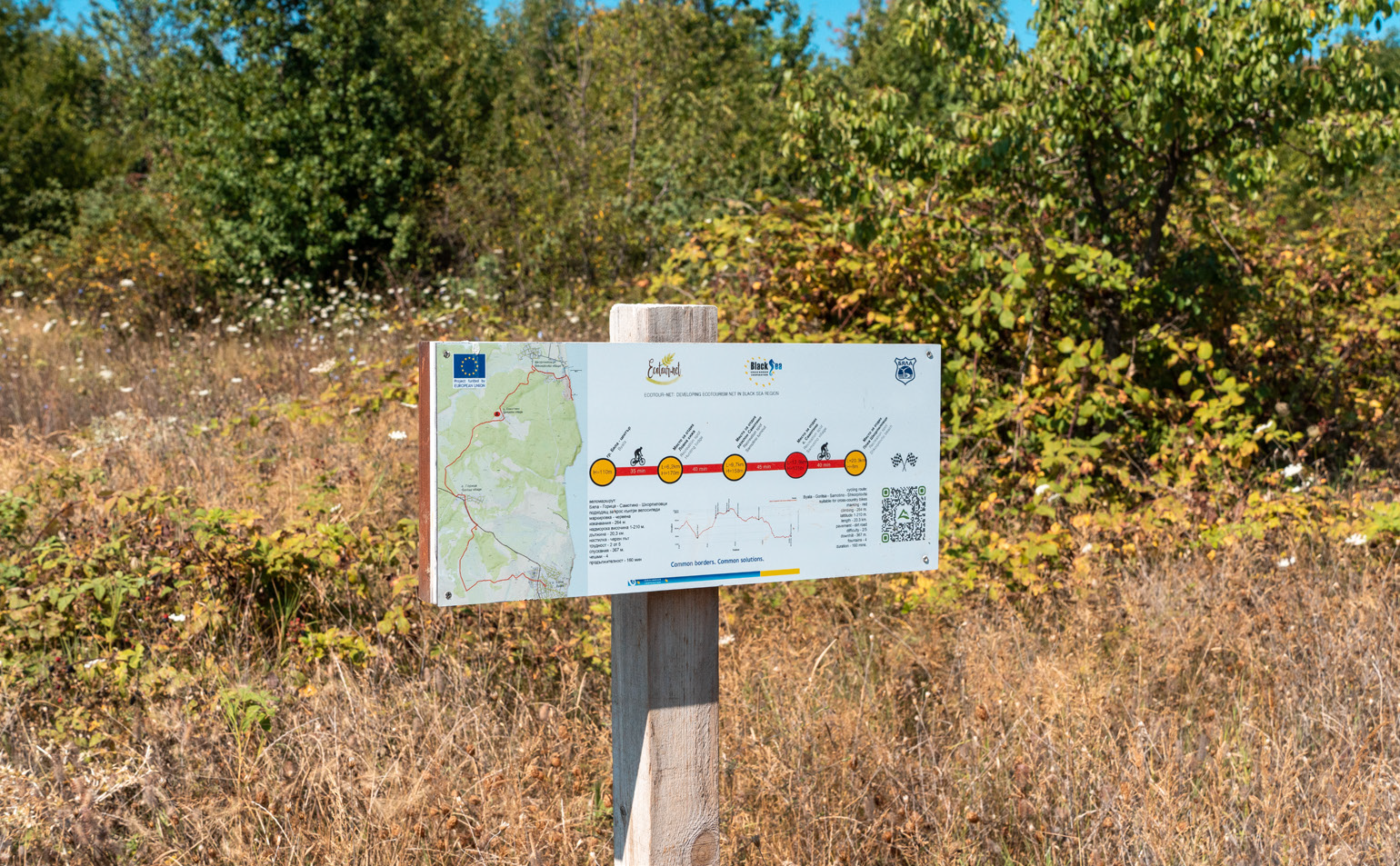
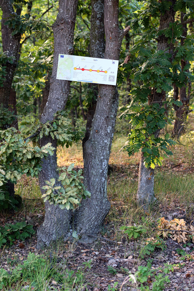
The route starts from the centre of Byala – waypoint 1, where there is an information board and where a public facility with tools for repairing bicycles will be established, and opportunity for food and water supply from nearby shops. Starting from the town square and following the markings, you cross the main road, then up through the industrial zone and the Farmyard you reach the highest point of the first short ascent. Nearby is the wine cellar Chateau Polychronoff, where cyclists can return for tasting and shopping wine.
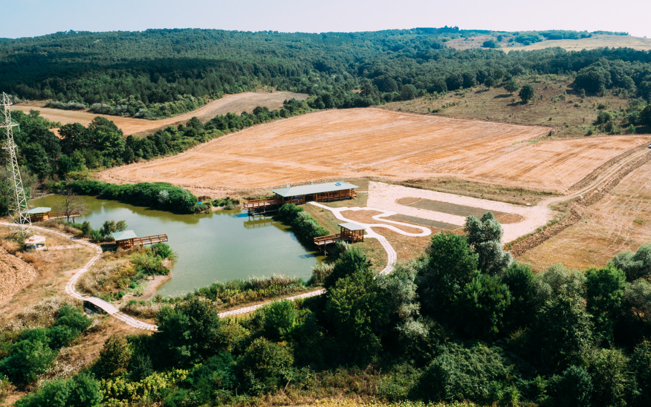
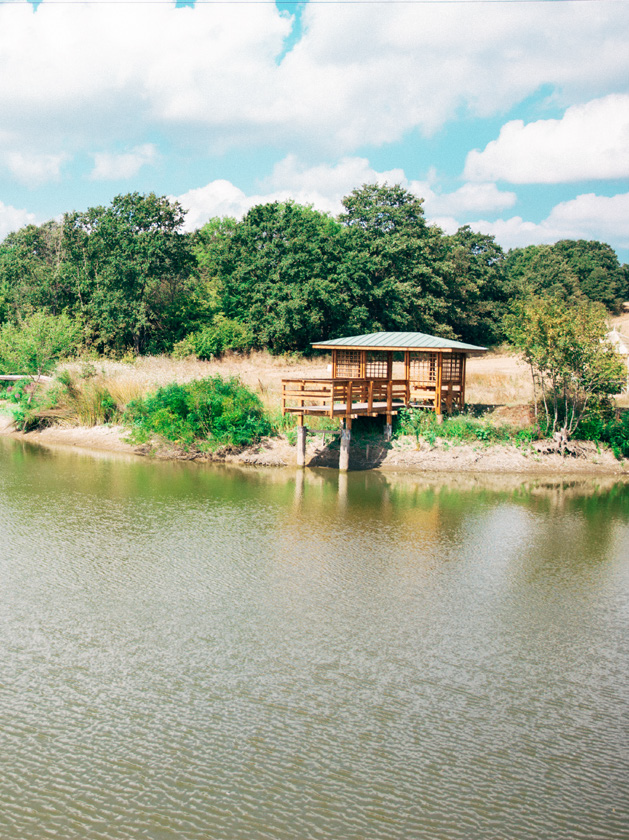
The route crosses the main road Varna - Burgas and continues along the interpretive route “Enika”. The route passes along a wide dirt road through an agricultural area with arable land and vineyards, climbs to the top of a hill overlooking the bay of Byala and the sea and then heads to the nearby wooded ravines with the river and lake Enika.
Enika Ecopark offers excellent conditions for fishing, rest and relaxation amidst the tranquillity and beauty of the surrounding nature.
With their diversity, the forest, the river and the lake are attractive not only for cyclists, but also for practitioners of hunting and fishing tourism, photo tourism, eco-tourism, hiking, cognitive tourism. The accessibility and location of the place – close to the town and on a large area, make it suitable also for organizing cultural and festival events, fairs, study visits for children, one-day green schools and camping near the infrastructure of the ecopark.
The freshwater basins in the area are home to the fish species crucian carp (Carassius), common rudd (Scardinius erythrophthalmus), roach (Rutilus rutilus), minnows and carps (Cyprinidae). Near the larger open water surfaces, the tourists can see singly or in groups Eurasian coot (Fulica atra), common moorhen (Gallinula chloropus), western march harrier (Circus aeruginosus). During migration and wintering, significant numbers of waterfowl gather in the lakes of Kamchiyska Mountain – the globally endangered Dalmatian pelican (Pelecanus crispus), great crested grebe (Podiceps cristatus), little grebe (Tachybaptus ruficollis), mallard (Anas platyrhynchos), grey heron (Ardea cinerea). Other species commonly observed here include the white stork / (Podiceps (Ciconia ciconia), common starling (Sturnus vulgaris), northern lapwing (Vanellus), grey partridge (Perdix perdix), pheasant (Phasianus), skylark (Alauda arvensis).
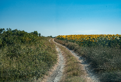
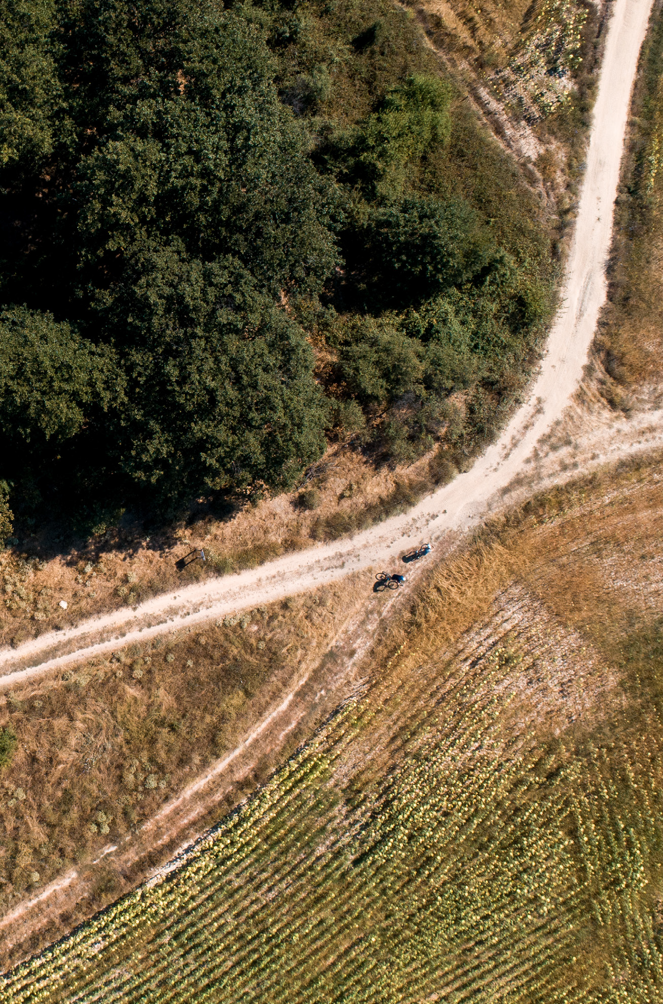
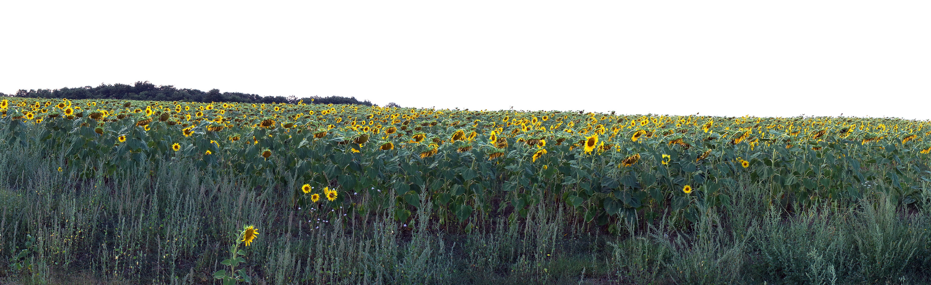
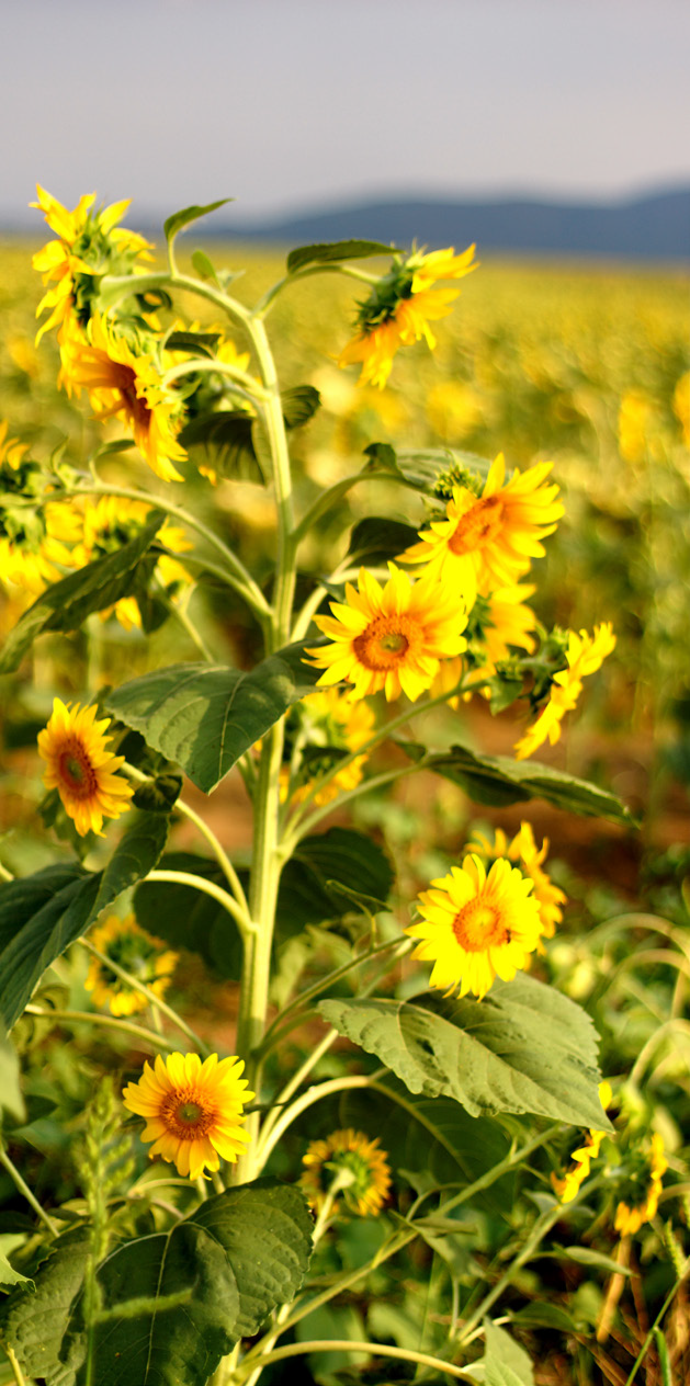
The route continues along a dirt road through arable land. The arable land is sown with various cereals, earthed-up crops, fodder plants. Among the green background of the surrounding areas, the blue flax, the yellow sunflowers and the flowering clover fields stand dry-loving grass communities, numerous early spring and summer wildflowers, medicinal grasses and various species of salep plants/ orchids (Orchidaceae).
In both the meadows and the fields you will hear the buzzing of various insects - various cristatus), species of butterflies, including Jersey tiger (Callimorpha quadripunctaria) – a priority species included in Annex II of the Habitats Directive, honeybees and bumblebees, crickets, locusts, beetles, caterpillars and ground wasps.
Reptiles and amphibians can be found in sunny places – common wall lizard (Podarcis muralis), green lizard (Lacerta viridis), blotched snake (Elaphe sauromates), European whip snake (Coluber caspius) and even horned viper (Vipera ammodytes). Typical for the territory are Hermann’s tortoise (Testudo hermanni) and the spur-thighed tortoise (Testudo graeca), which are endangered species and are listed in the Red Book as protected by the Biodiversity Act. The European hare (Lepus europaeus), the common buzzard (Buteo buteo), the black kite (Milvus) and the common kestrel (Falco tinnunculus) are often found in the open spaces of plain forests.
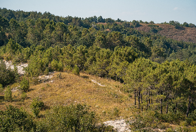
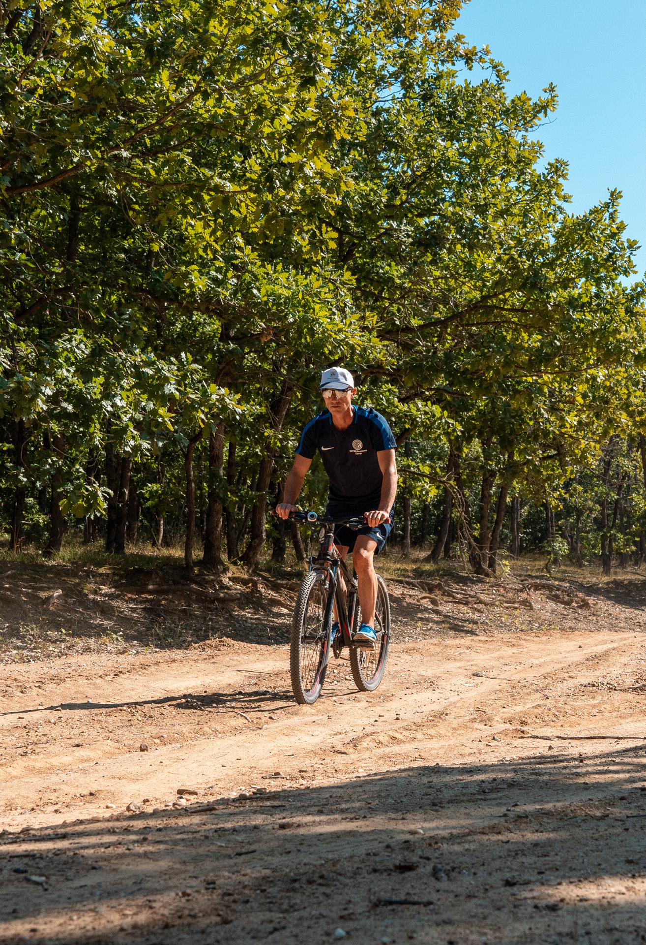
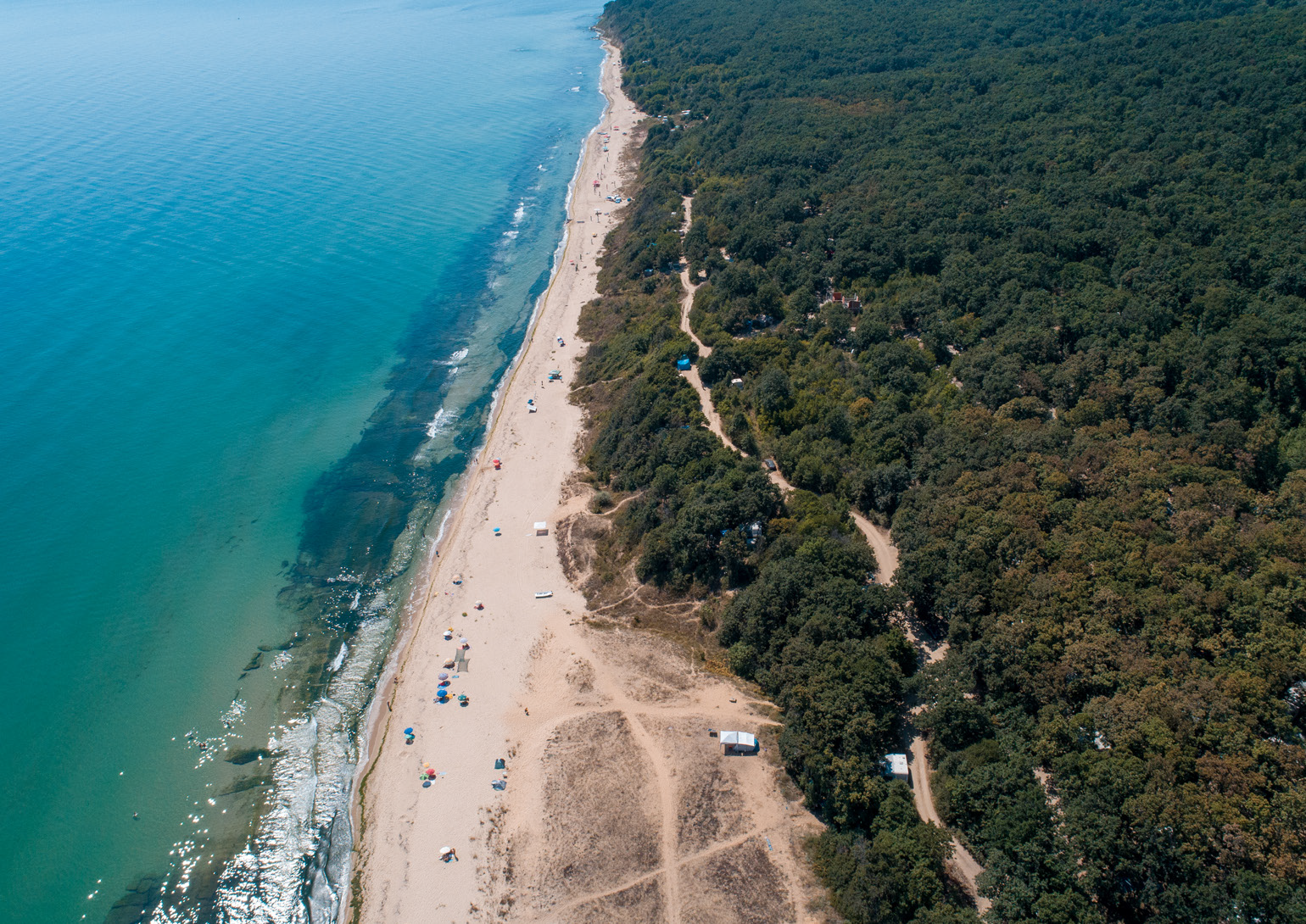
The route continues along the periphery of mixed deciduous forests with predominance of Turkey oak (Quercus cerris), Hungarian oak (Quercus frainetto), sessile oak (Quercus petraea), Hornbeam (Carpinus betulus), whose biodiversity is attractive to hunters and lovers of wildlife photography. The area, known for its bird species richness, is one of the most important places in the country. It is inhabit by the European honey buzzard (Pernis apivorus), the lesser spotted eagle (Aquila pomarina), the booted eagle (Hieraaetus pennatus), the woodlark (Lullula arborea), the European nightjar (Caprimulgus europaeus), the ortolan bunting (Emberiza hortulana), and the semicollared flycatcher (Ficedula semitorquata). Four species of woodpeckers: the middle spotted woodpecker (Dendrocopos medius), the Syrian woodpecker (Dendrocopos syriacus), the black woodpecker (Dryocopus martius) and the grey-headed woodpecker (Picus canus) and their habitats are protected by the Biodiversity Act. The large mammals typical of the wooded area include the roe deer (Capreolus capreolus), wild boar (Sus scrofa), red deer (Cervus elaphus), wolf (Canis lupus), red fox (Vulpes vulpes).
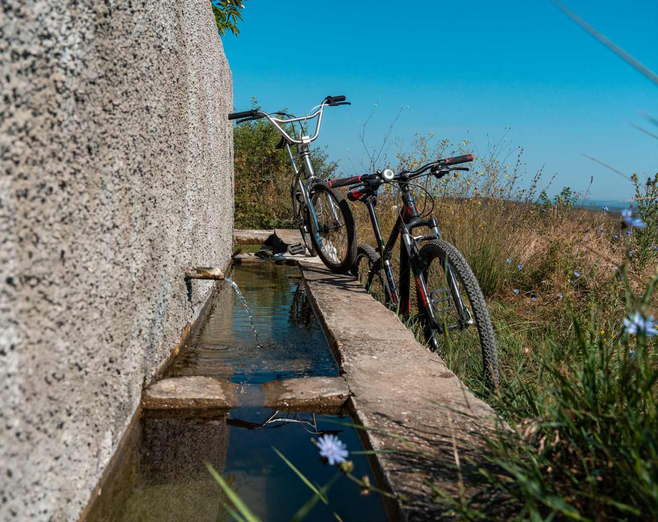
After this lowest point, the route begins to climb, and after a kilometre, it reaches a small ridge with agricultural field and a T-junction, where you have to turn right. Then the route continues its smooth ascent and after about 3.4 km you reach the first place for rest with a table and chairs. About 200-250 m farther, on the left side, you will see the Hunting Hut, and on the right side – the Yurta fountain.
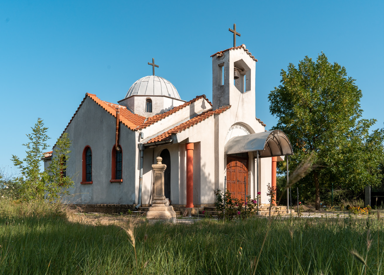
After it, turn right across the field, cross the main road Varna-Burgas and continue along the right wayside until entering the village of Goritsa. If you are hungry you can eat deliciously in the Pri Pancho restaurant, and you can visit the St. St. Constantine and Helena church, located very close to the route, as well as to refresh yourself at the village fountain. The route continues along the main road in the direction of Varna and immediately after leaving the village it turns right into a thinned oak forest along a dirt road, which after 1.3 km reaches the second place for rest.
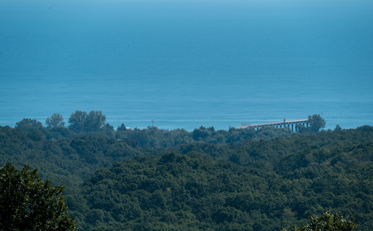
From there you have to cross the field heading to the nearby forest, passing under the power line, and continue the descent to the village of Samotino, known as the smallest village in Bulgaria. At one end is the third place for rest or picnic, from which you can see the beach of Shkorpilovtsi in the distance, and nearby, but slightly off the route, there is a fountain. Take two left turns to pass through the village. You can visit the discovered remains of a Late Antiquity fortress 2.2 km west of the village of Samotino. The potential of this site is not utilised and it is not known to tourists; therefore, it is necessary to take measures for its exposition, protection and inclusion in cognitive tourism routes.
At one end is the third place for rest or picnic, from which you can see the beach of Shkorpilovtsi in the distance, and nearby, but slightly off the route, there is a fountain.
Take two left turns to pass through the village. You can visit the discovered remains of a Late Antiquity fortress 2.2 km west of the village of Samotino. The potential of this site is not utilised and it is not known to tourists; therefore, it is necessary to take measures for its exposition, protection and inclusion in cognitive tourism routes.
After leaving Samotino, there is a pleasant descent through interlacing forest roads. The markings must be carefully followed, but even if you deviate, all roads lead to the outskirts of the village of Shkorpilovtsi. Upon reaching the asphalt, the route continues to the right, passing through the Ticha villa zone. Cyclists can choose another option – turn left and go to the centre of the village, to eat in a restaurant, to replenish their supplies from the shops or to see the St. Petka church. Afterwards they can join the route again and reach the resort and Shkorpilovtsi beach, which is the end point.
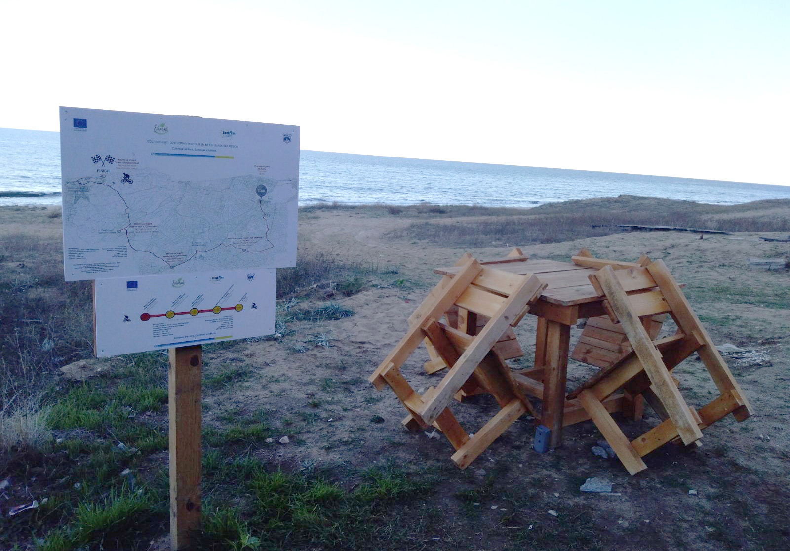
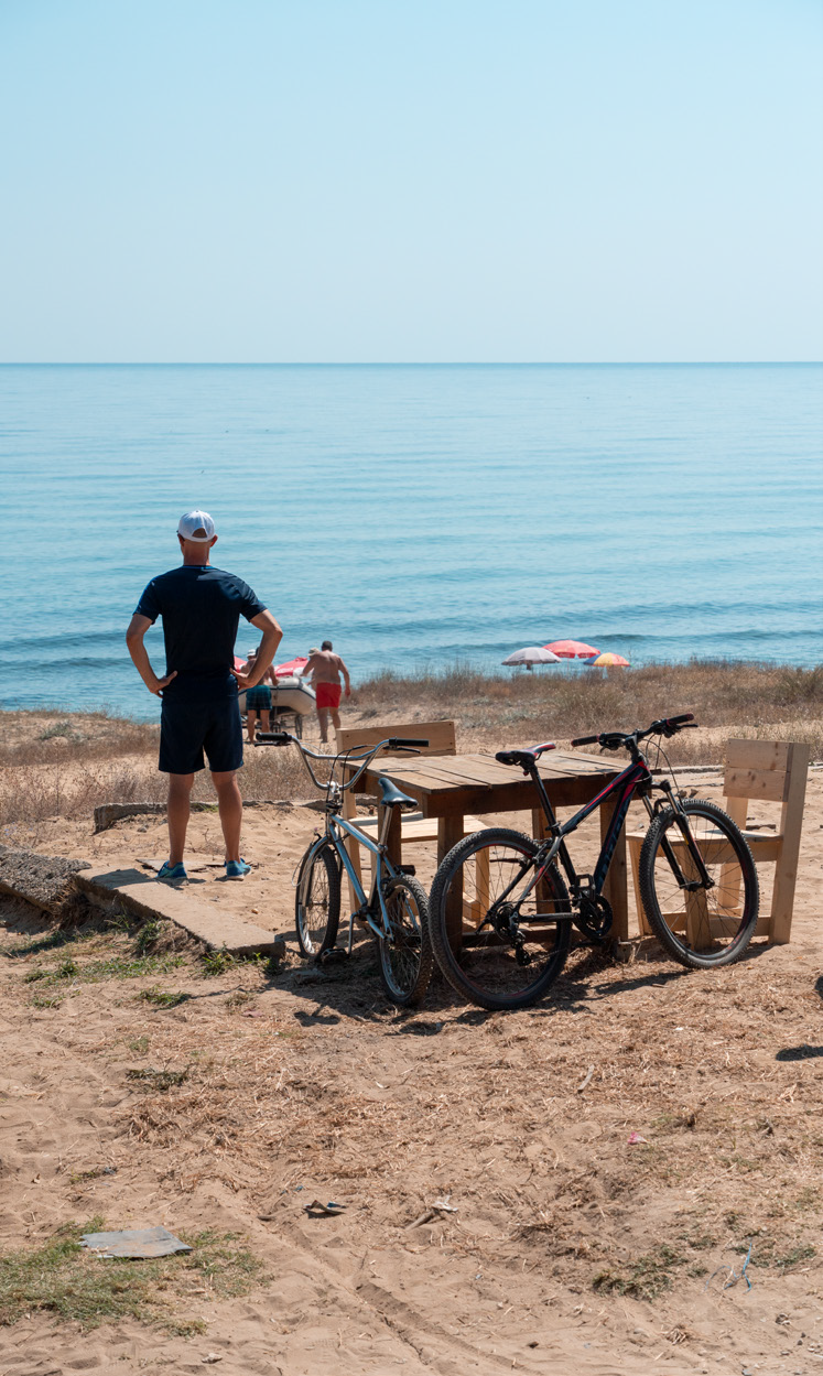
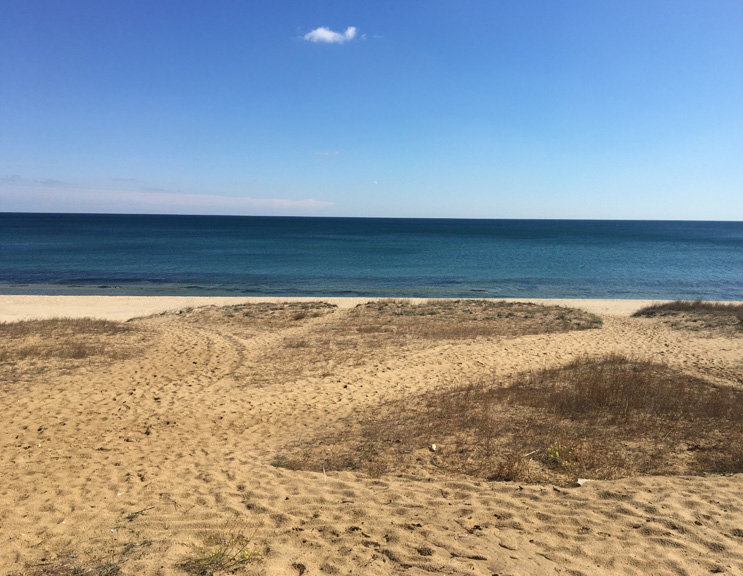
The wooded area combines the pleasure of cycling with unforgettable experiences for lovers of hunting and fishing tourism, phototourism, eco-tourism, hiking, cognitive tourism. The route crosses the Ticha villa zone along the bypass road, passes by the Eco Park Shkorpilovtsi hotel complex, continues along a shopping promenade along the Long Beach Resort and SPA hotel complex, descends to the coastal shopping promenade and continues to the Panorama holiday complex. Here is the final waypoint of the Red Route and the starting point of the Blue Route /connecting the Red with the Yellow Route/.
A place for rest has been created and markings and an information board have been placed.
Of course, to make it more interesting and to finish the ride at its starting point, you can follow the marked connecting section leading to one of the last wild beaches – that of Karadere. There begins the coastal route, which leads back to the town of Byala and ends at the entrance to the ancient fortress. In this way the cyclists can complete a circular route and add some wonderful sea views to their experience.
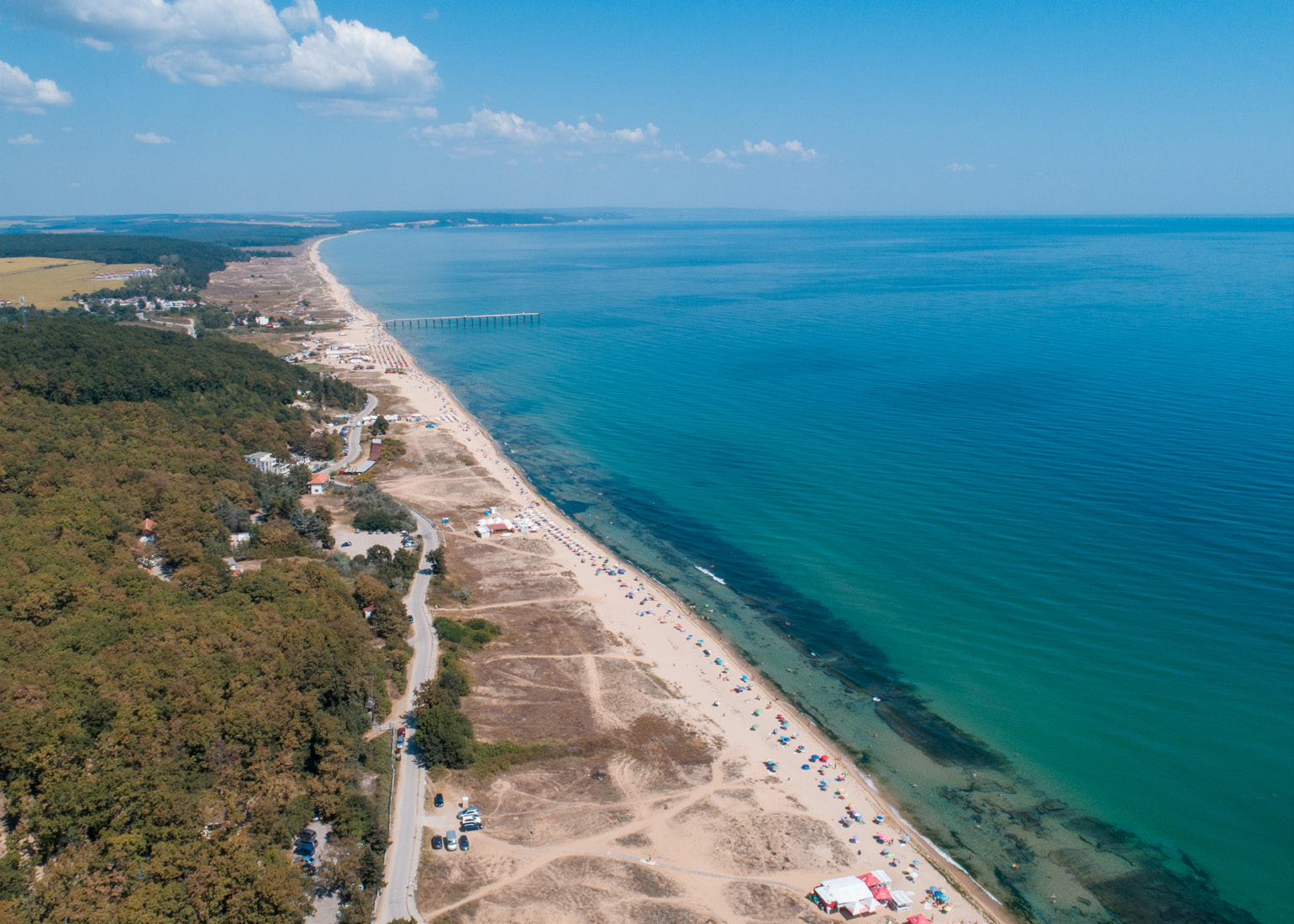
It is not by chance that we have selected the village of Shkorpirovtsi as a waypoint on the Red Route. The village of Shkorpolovtsi has the fame of a preferred place for sea tourism and recreation, combining the coolness of the forest, the widest beach in Bulgaria and a diverse in type and category hotel base.
There are 76 categorized accommodation places in the resort - 18 guest rooms, 2 family hotels, 7 guesthouses, 29 bungalows, Zora holiday village, 2 hotels and a holiday station. At the eastern end of the village, next to the beach, there are 2 hotels and the five-star hotel complex Long Beach Resort, a holiday base, children’s camps, holiday villa places, beach establishment for eating and entertainment, retail outlets.
A total of 63 restaurants and entertainment establishments with a total capacity of 3833 seats have been categorized. Near the village and the Shkorpilovtsi resort there is a new sports base with an open stadium – at the exit of the village of Staro Oryahovo.
In the immediate vicinity of the bridge on Shkorpilovtsi beach there is the newly built Camping Shkorpilovtsi, located on an area of 6,000 sq.m. on the first line behind the beach, only 200 meters from the sea.
Windsurf and kitesurfing school Campo operates on Shkorpilovtsi central beach, near the last waypoint of the Red Route. The place is a real treat for surfers due to the local thermals. It offers ideal conditions for both beginners and advanced – a constant crosswind, which favours sports: in the morning for beginners, and in the afternoon – for advanced. The school has modern surfing, windsurfing and kitesurfing equipment, catamaran, motor boat, wakeboard.
Tournaments in beach volleyball, beach football and beach tennis as well as entertainment events, festivals and competitions are organized annually on the beach of Shkorpilovtsi resort – the widest beach on the Black Sea coast.
The final stages of the prestigious international competition Breslau for off-road and retro cars hosted by the five-star hotel complex are organized annually in the region.
Archaeological remains have been discovered next to Shkorpilovtsi South Beach and experts are currently proceeding with research and restoration of finds from the ancient fortress (a quadriburg), the Early Christian basilica and tomb and a part of the Old Bulgarian Wall.
Along the beach and sand dune complexes you can see the characteristic psammophytic vegetation, represented by the species: sea holly (Eryngium maritimum), also called seaside eryngo, European searocket (Cakile maritima), sea spurge (Euphorbia paralias), sea kale (Crambe maritima), rhizome cereal species, such as mammoth wild rye (Leymus racemosus) and marram grass (Ammophila arenaria), Jurinea albicaulis, white sweetclover (Melilotus alba) also known as honey clover and white melilot, Centaurea arenaria, Silene thymifolia, sea medick (Medicago marina). Closed plant communities are formed on the stabilized sands, dominated mainly by field wormwood (Artemisia campestris), clematis (Cionura erecta).
The hotel and retail facilities and the availability of multiple catering establishments provide conditions for accommodation, rest, meals and recreation for cyclists, as well as maintenance of bicycles.
The natural resources, the archaeological finds and the existing good retail and tourism infrastructure in the area of the final waypoints of the Red Route give opportunities for development of both recreational tourism and alternative tourism products such as balneological, SPA and wellness tourism /the Kelara SPA centre at Long Beach Resort/, active sports tourism, passive sports and event tourism, surf tourism, fishing tourism, photo tourism, hiking tourism, adventure tourism, extreme tourism, cognitive tourism, festival, scientific and thematic tourism.
Goritsa
The biodiversity of Turkey oak (Quercus cerris), Hungarian oak (Quercus frainetto), sessile oak (Quercus petraea) and hornbeam (Carpinus betulus) is attractive to hunters and lovers of wildlife photography. The area is known for its bird species richness, and the forest area is inhabited by the large mammals roe deer (Capreolus capreolus), wild boar (Sus scrofa), red deer (Cervus elaphus), wolf (Canis lupus), red fox (Vulpes vulpes).
After Enika Ecopark, the route continues along a dirt road through arable land, sown with various cereals, earthed-up crops, fodder plants. It passes along the periphery of mixed deciduous forests and before it crosses the main road Varna - Burgas, the cyclists and eco-tourists reach waypoint 3. About 200- 250 m farther, on the left side, you will see the Hunting Hut, and on the right side – the Yurta fountain.
Here is an opportunity for refreshing at the fountain and relaxing at the place for rest near the village of Goritsa with a panoramic view of a forest road.
The route continues along the road Varna - Burgas, in the direction of the village of Goritsa. In the village you can visit the local Orthodox church St.St. Konstantin and Elena. A great opportunity for rest, relaxation and eating is the restaurant Goritsa/Pri Pancho, located next to the main road Varna-Burgas, before the village of Goritsa. The restaurant offers a variety of traditional meat and fish dishes throughout the year.
After leaving the village of Goritsa, the route turns right into a dirt road and enters an oak forest, passes arable land and enters again in oak massifs. After a short - about 1.3 km transition, it enters the lands of the village of Samotino, where there is a place for rest and a viewpoint overlooking the sea.
You can visit the discovered remains of a Late Antiquity fortress 2.2 km west of the village of Samotino. The potential of this site is not utilised and it is not known to tourists; therefore, it is necessary to take measures for its exposition, protection and inclusion in cognitive tourism routes.
After passing through the village of Shkorpilovtsi and bypassing the villa zone and hotel complex Long Beach Resort, the route descends to the coastal shopping promenade and continues along it to the area of the holiday complex Panorama. Here is the final waypoint of the Red Route and the starting point of the Blue Route /connecting the Red with the Yellow Route/. A place for rest has been created and markings and an information board have been placed. Along the beach and sand dune complexes you can see the characteristic psammophytic vegetation. Closed plant communities are formed on the stabilized sands, dominated mainly by field wormwood (Artemisia campestris), clematis (Cionura erecta)
Beach Of Shkorpirovtsi Resort
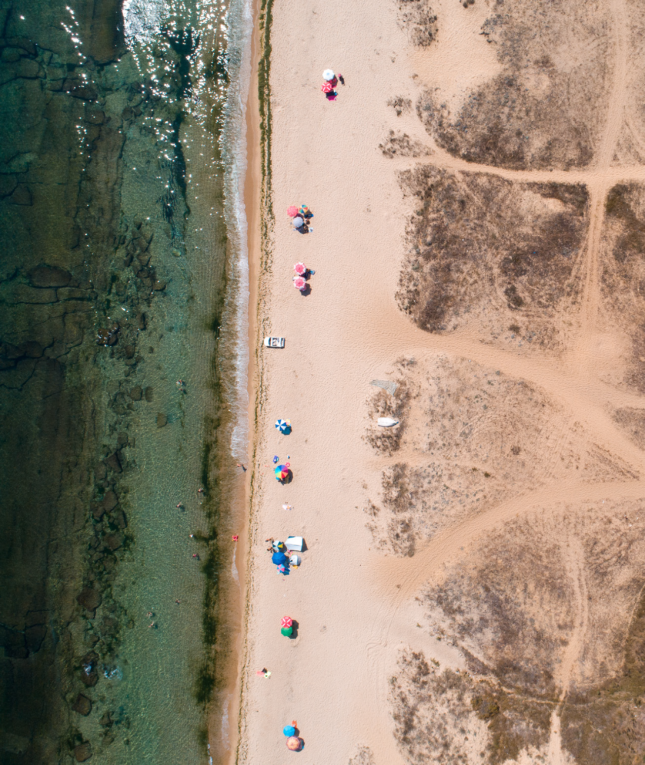
After passing through the village of Shkorpilovtsi and bypassing the villa zone and hotel complex Long Beach Resort, the route descends to the coastal shopping promenade and continues along it to the area of the holiday complex Panorama. Here is the final waypoint of the Red Route and the starting point of the Blue Route /connecting the Red with the Yellow Route/. A place for rest has been created and markings and an information board have been placed. Along the beach and sand dune complexes you can see the characteristic psammophytic vegetation. Closed plant communities are formed on the stabilized sands, dominated mainly by field wormwood (Artemisia campestris), clematis (Cionura erecta)